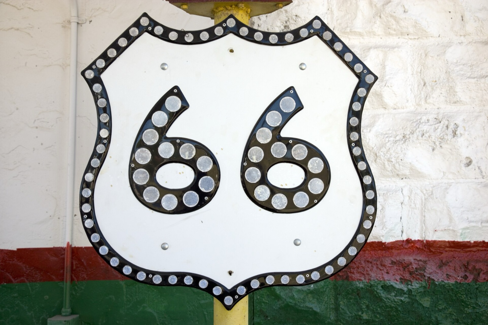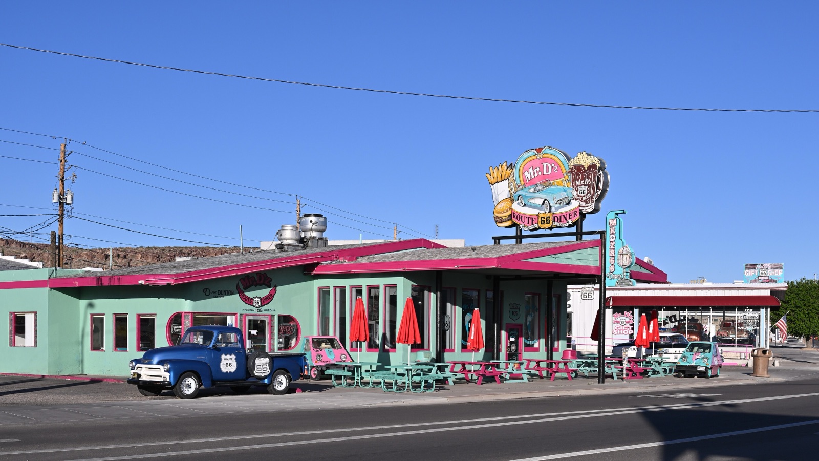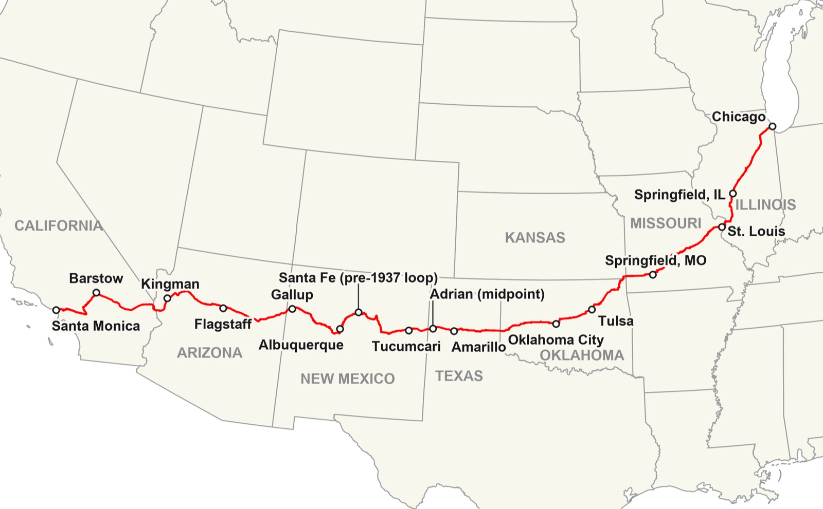
Route 66 Kansas is the shortest state on the whole road: about 13 miles across the southeast corner of Cherokee County, through just three towns, Galena, Riverton and Baxter Springs. You can drive it in half an hour, but give it a slow morning. In that short run you get a lead-mining boomtown, the tow truck that inspired a Pixar character, a general store open since 1925, the last Marsh arch bridge on Route 66, and a 1930 cottage-style gas station that is now the Kansas Route 66 Visitor Center.
I'm Helena. I crossed these 13 miles again in April 2026, on the drive from Chicago to Santa Monica that became the Centennial Edition of my Route 66 Field Manual. Kansas is the state people rush, because it looks like nothing on a map. It is the opposite: the most original pavement per mile of any state on the route, and the place where the road's backstory, mining and all, is still right on the main street.
How many miles of Route 66 are in Kansas?
About 13. Kansas tourism uses 13.2 miles, the National Park Service says roughly 14, and Wikipedia measures one alignment at a little over 11, because the road through Galena moved a few blocks more than once. That is barely half a percent of the 2,448 miles from Chicago to Santa Monica.
Coming from Joplin, Missouri, Route 66 enters Kansas at Galena, runs west across the Spring River to Riverton, then turns south past the Rainbow Bridge over Brush Creek and down Military Avenue in Baxter Springs. A few miles later you are in Oklahoma, heading for Quapaw and Commerce. After the highway was decommissioned in 1985, the Kansas stretch was signed as K-66 from the Missouri line to Riverton and as US 69 Alternate from Riverton south to Oklahoma, so look for those numbers on the signs too.
Kansas Route 66 stops at a glance
| Town | Stop | Why stop |
|---|---|---|
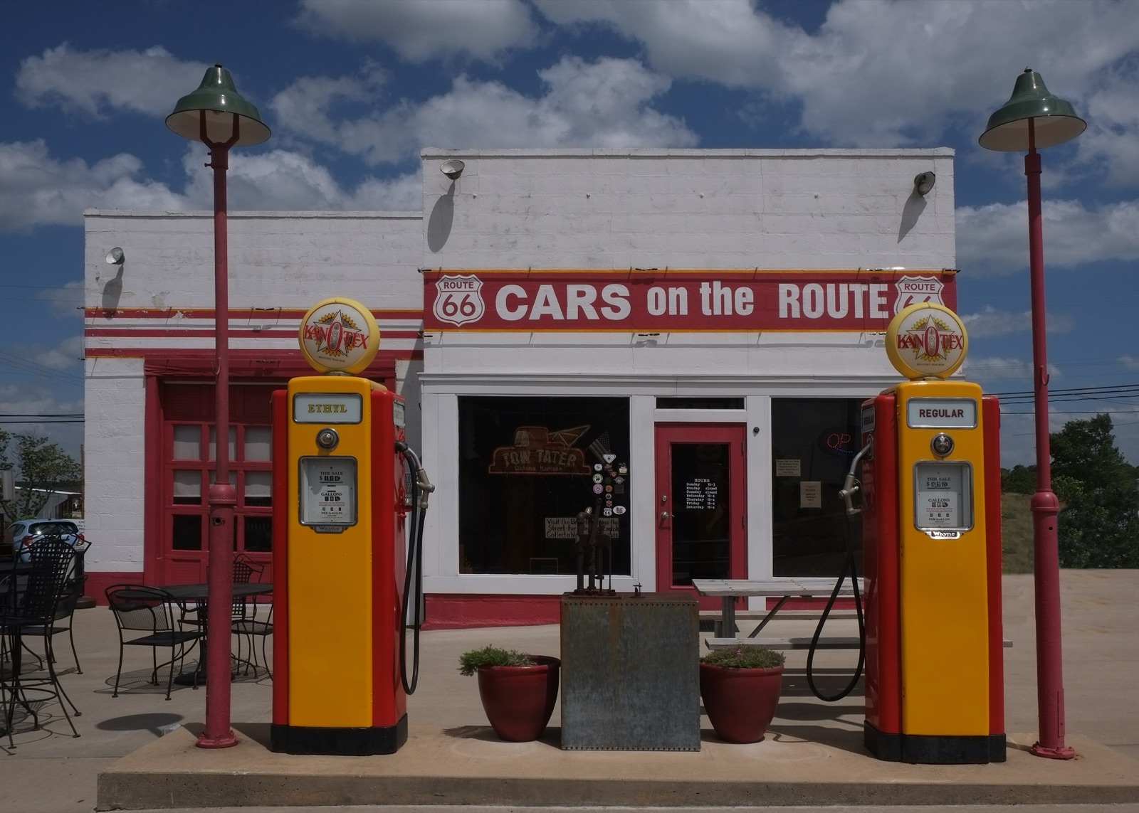
| Galena | Cars on the Route | Restored Kan-O-Tex station and Tow Tater, the 1951 boom truck behind Pixar's Mater |
| Galena | Route 66 Centennial Arch | 100 feet wide, built from trusses of a Joplin school gym, with a gorilla on top |
| Galena | Front Street murals and the drive-through shield | The best concentration of roadside art in the state |
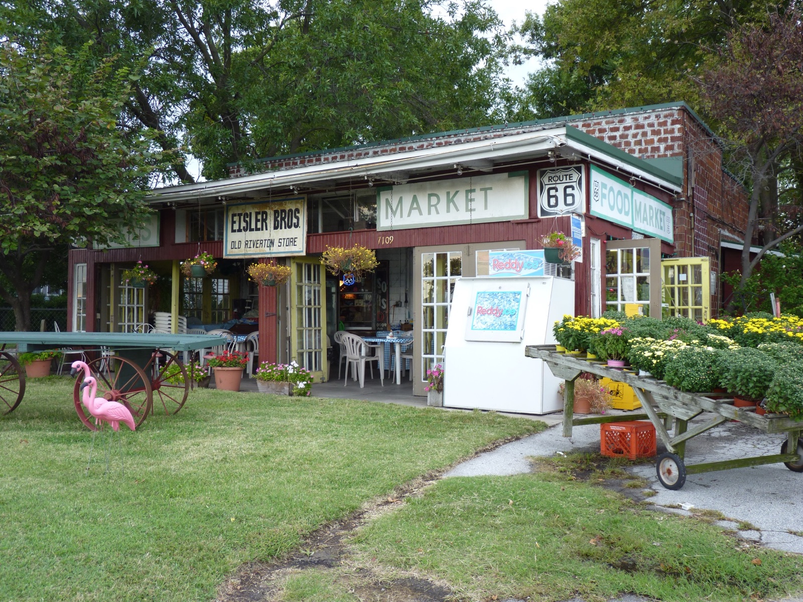
| Riverton | Nelson's Old Riverton Store | General store open since 1925, sandwiches sliced to order |
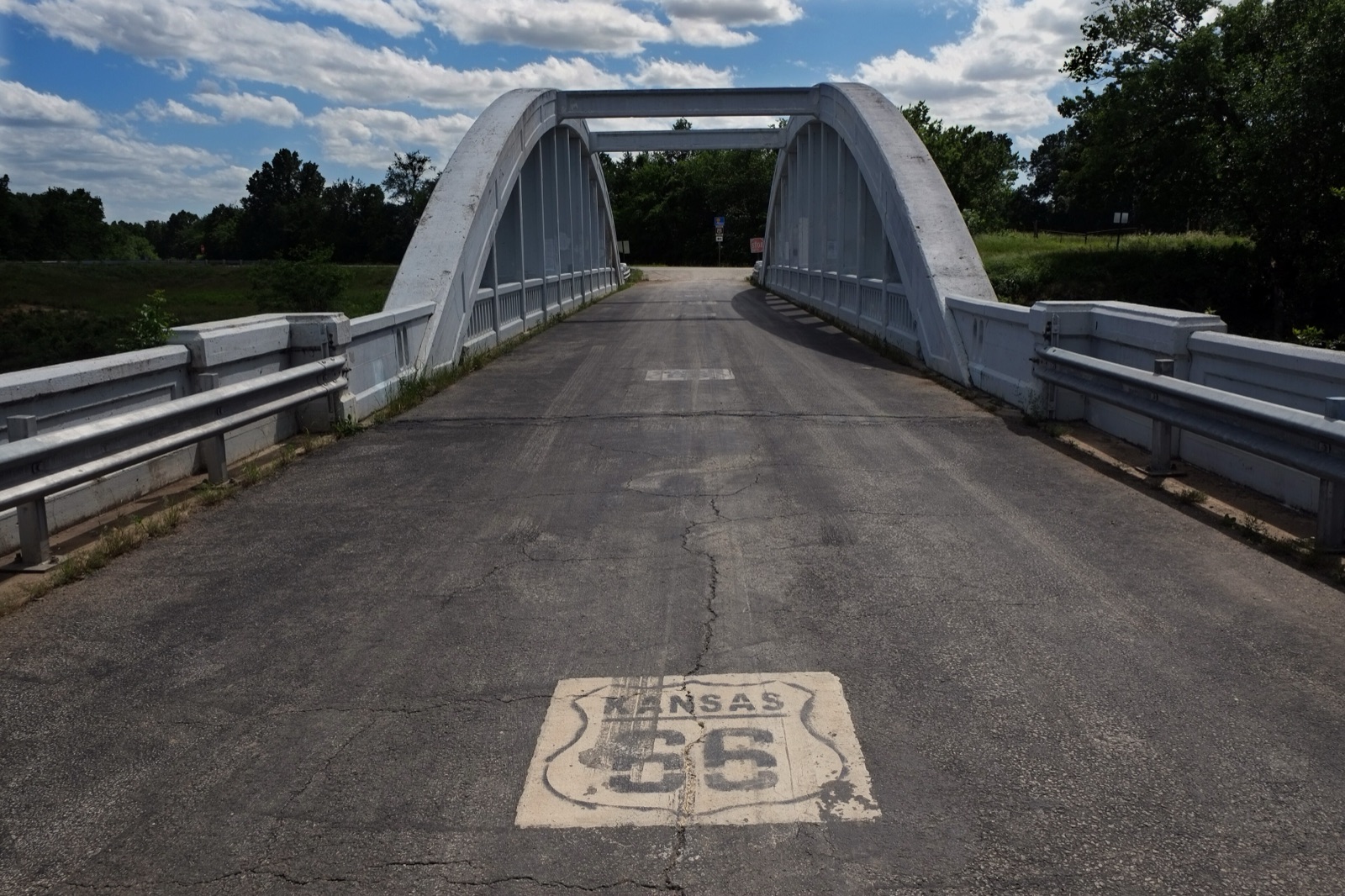
| Near Riverton | Rainbow Bridge | 1923 concrete arch over Brush Creek, the last Marsh arch on Route 66 |
| Baxter Springs | Kansas Route 66 Visitor Center | 1930 Tudor-style gas station at 940 Military Avenue |
| Baxter Springs | Downtown murals and the Heritage Center | Cowtown, Civil War and mining history in one walk |
Why the interstate never touched Route 66 in Kansas
Here is the fact that makes Kansas special. When Interstate 44 replaced Route 66 in this corner of the country in 1961, it ran straight from Missouri into Oklahoma and missed Kansas by about a quarter of a mile. The National Park Service calls Kansas the only state that was completely bypassed when the interstate replaced Route 66.
So is Kansas the one state where Route 66 was never bypassed? In a way, yes. No interstate was ever built on top of it or beside it, so the old road was never reduced to a frontage road. It stayed the main street of all three towns. The flip side is that the traffic went away all at once, and the motels, truck stops and cafes that lived on it went with it.
Kansas was also early. According to the National Park Service, Kansas and Illinois were the only two states whose entire stretch of Route 66 was already hard-surfaced when the highway was commissioned in 1926, because the mining towns had paved their roads to move ore. If you want the bigger picture of where the old road and the interstates part ways, I compared them in Route 66 vs I-40.
Galena, Kansas: the mining town on Route 66
Galena is named after the lead ore found here in the spring of 1877. The town was laid out by the Galena Mining and Smelting Company and went by Short Creek and briefly Bonanza before the mineral's name stuck. It grew into a boomtown almost overnight, and it sat in the middle of the Tri-State mining district of Kansas, Missouri and Oklahoma.
The numbers explain the swagger. The Kansas Geological Survey says that from 1850 to 1950 the Tri-State district produced 50 percent of the zinc and 10 percent of the lead in the United States. The last active mine in the Kansas part of the district, two miles west of Baxter Springs, closed in 1970. The waste piles of crushed rock, called chat, once covered about 4,000 acres of southeastern Cherokee County, and the area became an EPA Superfund cleanup site in the early 1980s. Galena counted 2,761 residents in the 2020 census.
Before you leave town, look for the Galena Mining and Historical Museum, housed in an old railroad depot with a locomotive parked beside it. Hours in small museums like this one depend on volunteers, so call ahead.
Galena Route 66 stops: Cars on the Route and Tow Tater
Cars on the Route, at 119 North Main Street, is a restored Kan-O-Tex service station with old pumps out front, a gift shop and a small cafe. Parked beside it is Tow Tater, a 1951 International boom truck that inspired the tow truck Mater in Pixar's Cars.
The Centennial Arch, the drive-through shield and the murals
Galena is where the centennial is easiest to see. In August 2025 the town raised the Route 66 Centennial Arch over Front Street, near Cars on the Route: 100 feet wide, one foot for every year of the road. Its barrel trusses were salvaged from the gym of Joplin's East Middle School, which was destroyed in the 2011 tornado, and the base is painted with 16 murals. Former mayor Dale Oglesby first pitched the idea in 2011.
In April 2026 an eight-foot, 400-pound Gus the Gorilla, the mascot of Pittsburg State University, was installed on top, and the plan is to add a bulldog, an eagle and a lion for other area schools. Also on Front Street is a 16-foot drive-through Route 66 shield. Around town, Kansas tourism counts a 2013 "Greetings from Galena" tile mural with more than 400 tiles, an American flag made of 169 Kansas license plates, and a 22-foot Texaco "Big A" giant outside Gearhead Curios.
East of downtown, the old Front Street alignment crosses the railroad tracks on a viaduct before the road reaches the Missouri line.
Riverton and the Spring River
West of Galena the road crosses the Spring River, and this is a crossing with a story. Kansas once had three Marsh rainbow arch bridges on Route 66: the Rainbow Bridge over Brush Creek and two over the Spring River. The Spring River arches are gone, replaced by modern spans, which is exactly why the one that survived matters so much.
Nelson's Old Riverton Store
If you only stop once in Kansas, stop here. The red-brick store at 7109 SE Highway 66 opened on March 20, 1925, a year before Route 66 even had its number. Leo and Lora Williams built it as a gas station and general store, the Eisler family bought it in 1973, and Scott Nelson, who started working for the Eislers at 14, bought it in 2011. It has been on the National Register of Historic Places since 2003, listed as Williams' Store.
Kansas tourism wrote it up again in July 2026: sandwiches made with more than a dozen sliced meats, homemade pie, sodas from a 1939 Coca-Cola cooler, and the old living quarters turned into a room of Route 66 memorabilia. The enclosed porch seats 15 to 20. The National Trust for Historic Preservation lists a $10,000 grant to the store for new wooden French doors. The store's number is 620-848-3330; call ahead if you are arriving late in the day.
Before you leave town, look for Riverton's 20-foot metal Route 66 shield, built by the local FFA chapter in 2018 from repurposed tire rims.
The Rainbow Bridge over Brush Creek
About two miles west of Riverton, a short one-way road leads to the Rainbow Bridge. It was built in 1923 to a design by James Barney Marsh, it is the only bridge of its type left on the entire length of Route 66, and it has been on the National Register of Historic Places since 1983, listed as the Brush Creek Bridge.
The highway itself now crosses Brush Creek on a newer bridge right next to it, because the arch was too narrow for modern traffic. But you can still drive across the old one, slowly, with the Kansas 66 shield painted on the deck. Local news reported in August 2025 that a refurbishment of the bridge had been completed that May, so it looks its best for the centennial.
Baxter Springs, Kansas
Baxter Springs is the biggest of the three towns, about 4,000 people, and the one with the deepest history. It was the scene of a Civil War massacre in 1863, when Quantrill's raiders attacked, and it is home to a national cemetery. After the war it became the first cowtown in Kansas, then a lead and zinc mining town. In 1926, Military Avenue became Route 66.
Kansas Route 66 Visitor Center
The visitor center is at 940 Military Avenue, in a station built in 1930 by the Independent Oil and Gas Company. It was designed in the Tudor Revival style to look like a small cottage and blend in with the houses around it. The company merged with Phillips Petroleum in 1931, so it became a Phillips 66 station, and it sold Phillips fuel until 1958. The station was listed on the National Register in 2003, bought by the local historical society in 2005, and restored to its 1940s look as the visitor center in 2007.
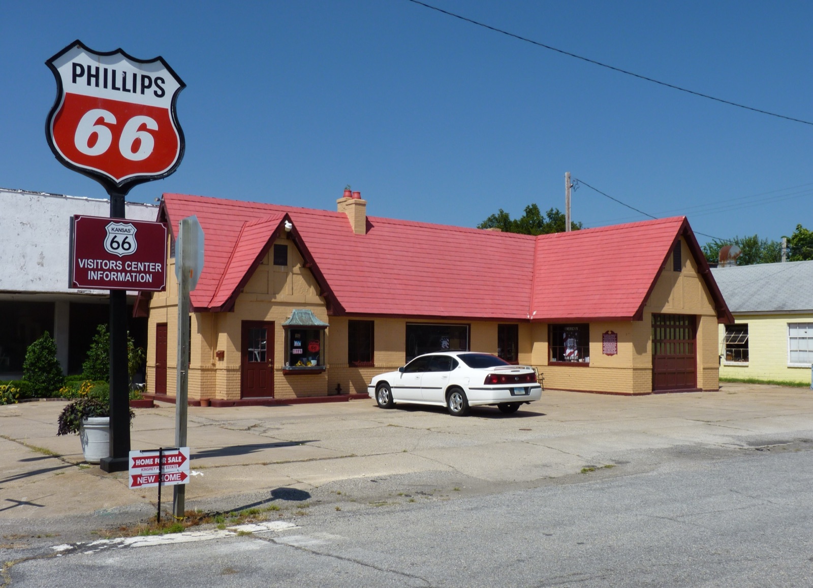
The center is run entirely by volunteers, and its hours depend on how many volunteers it has. In a May 2026 interview, Mary Billington of the visitor center said that more volunteers means more open hours. If it is closed when you pass, go to the Baxter Springs Heritage Center and Museum instead.
Downtown murals, and what closed
Downtown, a 100-foot mural painted in 2024 tells the town's story from its Indigenous heritage through the cattle drives, the Civil War, the railroad and Mickey Mantle's Whiz Kids years. A roadside park has two giant sunflowers holding a swinging Route 66 shield.
One thing you won't find anymore is Cafe on the Route. The restaurant at 1101 Military Avenue, in a 19th-century former bank building, was featured on the Food Network's Diners, Drive-Ins and Dives, which made it famous with Route 66 travelers. Route 66 News reported that it closed abruptly at the end of 2012, reopened under a new owner in late 2014, and closed again less than a year later, and the building was put up for sale in 2016. I found nothing reopened there in 2025 or 2026, so plan your Kansas lunch at the Riverton store instead. For the rest of the road, my list of the best Route 66 diners only includes places that are still serving.
Route 66 centennial events in Kansas
Kansas did its centennial in small-town style. On April 30, 2026, Baxter Springs released 100 lanterns into the sky with live music. Then the summer calendar had Galena Days in early June, with a movie night, a dance and a car show, the Centennial Caravan's Kansas stop on June 19, and the Great Race classic car rally through Galena, Riverton and Baxter Springs on June 23. Baxter Springs followed with its Freedom USA fireworks day on July 3.
What's left on the official calendar is the Route 66 Race Across Kansas on November 28, 2026: a half marathon moving east to west across the state, with fun runs and walkers welcome. It is free, but you have to register ahead. For everything else happening along the road around the 100th birthday on November 11, see my Route 66 centennial events calendar.
How long to spend on Route 66 in Kansas
Without stops, the 13 miles take about half an hour. With the stops in this guide, plan two to three hours: half an hour in Galena, lunch in Riverton, ten minutes at the Rainbow Bridge, and half an hour in Baxter Springs. That is why I build Kansas into the same day as Oklahoma, the way I did in my 2-week Route 66 itinerary, where day 4 runs from Carthage to Tulsa.
Where to sleep is the one gap. I could not verify a vintage motel taking overnight guests in Kansas in 2026, so I sleep at Boots Court in Carthage, Missouri, the night before and roll into Galena in the morning. Details are in my guide to the best Route 66 motels.
Before and after Kansas: Joplin and Commerce
East of the state line, Joplin, Missouri, is the nearest big town, with plenty of places to eat and sleep. The Centennial Arch itself is a Joplin story, built from a school destroyed in the city's 2011 tornado.
West of Baxter Springs, the road enters Oklahoma at Quapaw and runs through Commerce, Mickey Mantle's hometown, then on to Miami and the nine-foot-wide Ribbon Road. Keep going with my guide to Route 66 stops in Oklahoma, and if you want every town in order on one page, use the Route 66 map with cities.
One practical tip: follow the "Historic Route 66" signs and the K-66 and US 69 Alternate markers, not your navigation app, which will keep trying to send you back to I-44. Kansas is also where a printed map earns its keep, because the alignments through Galena and around the Spring River are easy to miss. The Field Manual covers all 2,448 miles with 169 maps, one chapter per state, and Kansas gets its own. If you are still putting the whole trip together, start with my Route 66 road trip planner.
The short version
Route 66 in Kansas is 13 miles you should not rush. Take the Tow Tater photo in Galena, eat a sandwich at the 1925 store in Riverton, drive across the last Marsh arch on the route, and say hello to the volunteers in the cottage station on Military Avenue. Then Oklahoma, with its 400-plus miles of old road, is waiting. It is all mapped, town by town, in the Route 66 Field Manual.