A Route 66 road trip runs 2,448 miles through eight states, from Adams Street in Chicago to the pier in Santa Monica. Give it at least 14 days if you want to drive the old road instead of the interstate, and 3 weeks if you like long lunches and museum stops. Go in spring or fall, drive east to west, book the classic motels by phone, and carry a guide that was checked recently, because closures on this road change every season.
I'm Helena. In April 2026 I drove the whole thing again, Chicago to Santa Monica, in 23 days, calling motels and logging coordinates as I went. This planner is everything I wish someone had handed me before my first trip.
How many days do you need for Route 66?
Fourteen days is the honest minimum for the full road. That works out to roughly 175 miles a day, which sounds easy until you remember that much of the old alignment is two lanes, small-town speed limits and stoplights, with a photo stop every twenty minutes.
Here is how I'd think about it:
- 10 days or fewer: you'll spend a lot of time on I-55, I-44 and I-40, and you'll see Route 66 mostly through the windshield. If that's all the time you have, pick two or three states and do them properly.
- 14 days: the full road at a steady pace, with one or two short days built in. This is what most couples I talk to end up doing.
- 18 to 23 days: room for side trips, a rest day in Albuquerque or Flagstaff, and slow mornings. My April drive took 23 days because I was verifying everything, and I never once felt rushed.
If you want the full day-by-day plan, I wrote out my 2-week Route 66 itinerary, and the math for shorter and longer trips is in how long Route 66 takes.
One more thing: add a buffer day near the end. Weather, a flat tire or a museum you can't leave will eat one day somewhere, and it is much nicer to lose it in Arizona than to race across the Mojave to make a flight.
East to west or west to east?
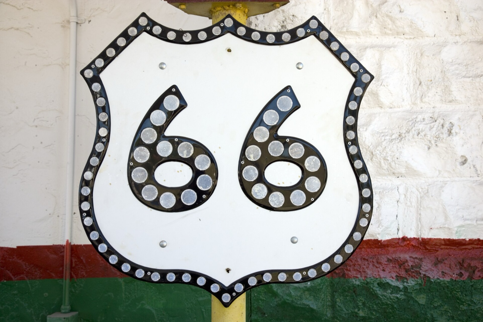
The road starts at Adams Street in Chicago and ends at the Pacific; I wrote up exactly where Route 66 starts and ends, signs included.
I drive east to west, Chicago to Santa Monica, and I recommend it to almost everyone. It's the direction the road was traveled in its most famous years, the story builds from Midwestern farm towns to open desert, and you finish at the Pacific instead of in a Chicago traffic jam.
West to east has real advantages too. You get the desert out of the way early, before the summer heat peaks, and one-way rental prices can differ by direction, so price it both ways.
The one practical drawback of driving west is the afternoon sun. From Oklahoma onward you'll be driving into it in the late afternoon, so plan your longest stretches for the morning and keep good sunglasses on the dash.
When to go on Route 66
The sweet spot is May to early June, and mid-September through October. Days are warm, most seasonal businesses are open, and you avoid the two real hazards of this road: desert heat and mountain snow.
Summer is popular, but the Mojave in July is no joke. Needles, California averages a high around 110°F in July, and in July 2024 it posted an average monthly temperature that beat Phoenix's record for the hottest month in a U.S. city. A breakdown out there in August is a safety problem, not an inconvenience.
Winter brings the opposite problem. Flagstaff sits at about 7,000 feet and averages more than 100 inches of snow a year, and the high plains of Texas and New Mexico can ice over fast. Some museums and small businesses also keep shorter winter hours.
Fall is my favorite season out there, and I wrote a whole piece on driving Route 66 in the fall. If you're going in the centennial year, check the Route 66 centennial events calendar first: festivals are wonderful, but they also fill every motel in town.
Route 66 map by state: miles and key stops
These are the approximate mileages for the historic route in each state. Exact numbers shift depending on which alignment you follow, since the road was rerouted many times between 1926 and 1985.
| State | Approx. miles | Key stops |
|---|---|---|
| Illinois | 301 | Begin sign in Chicago, Gemini Giant in Wilmington, Pontiac museum |
| Missouri | 317 | Chain of Rocks Bridge, Ted Drewes in St. Louis, Cuba murals |
| Kansas | 13 | Galena, Rainbow Bridge near Riverton |
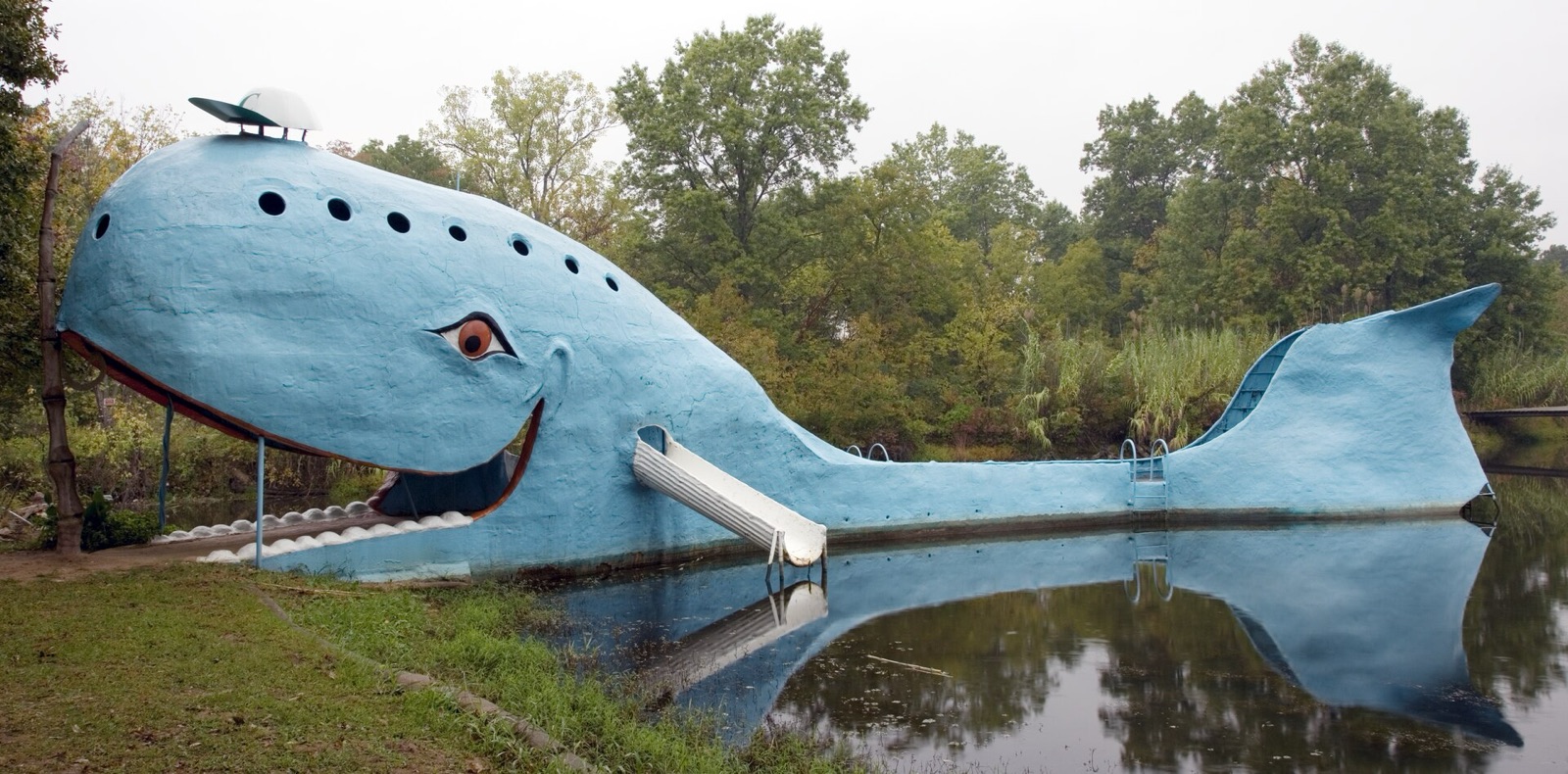
| Oklahoma | 432 | Blue Whale of Catoosa, Arcadia Round Barn, Clinton museum |
| Texas | 186 | U-Drop Inn in Shamrock, Cadillac Ranch, Midpoint Cafe in Adrian |
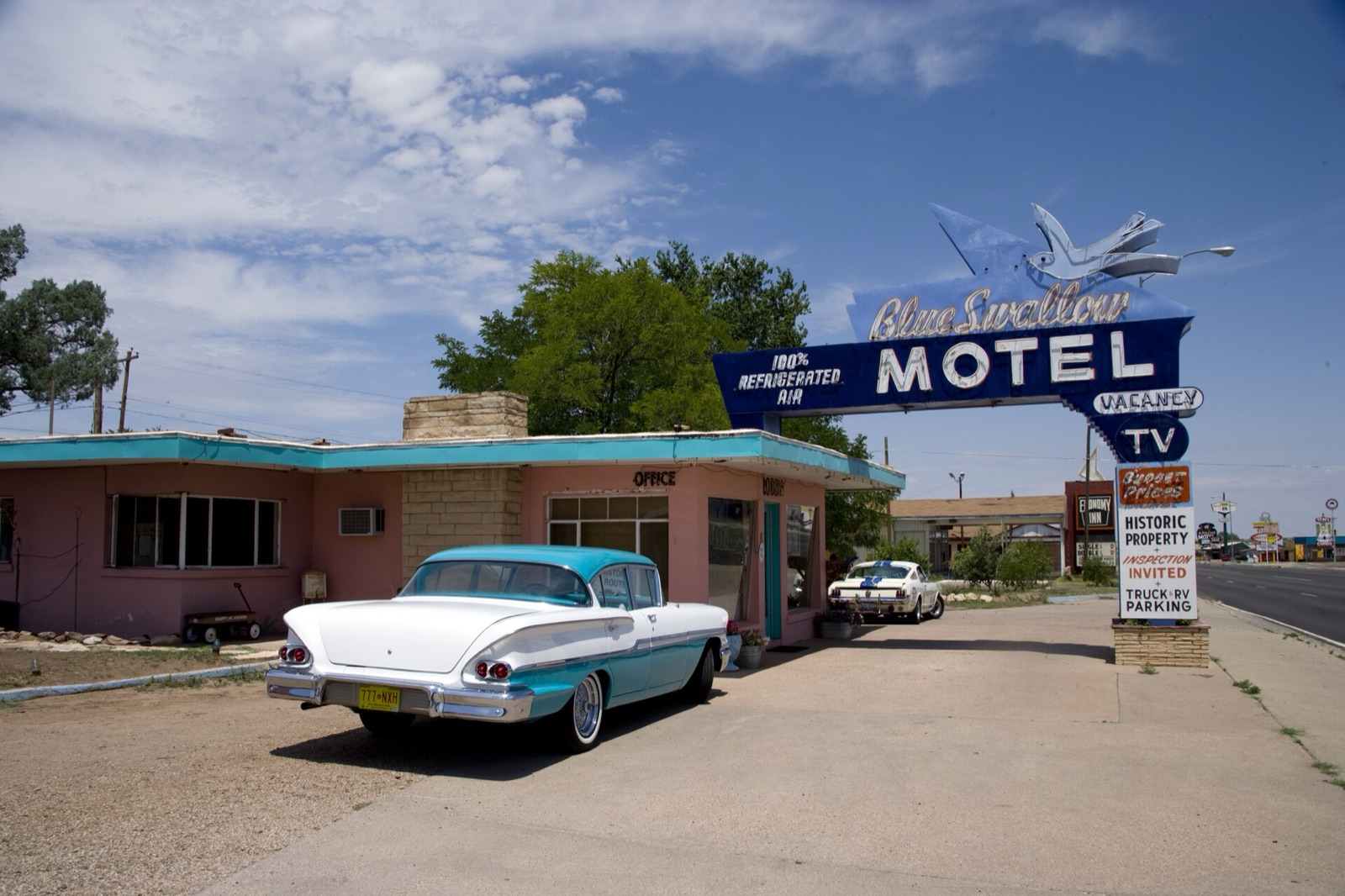
| New Mexico | 487 | Blue Swallow Motel in Tucumcari, Blue Hole in Santa Rosa, Gallup |
| Arizona | 401 | Petrified Forest, Wigwam Motel in Holbrook, Seligman, Oatman |
| California | 316 | Needles, Amboy, Santa Monica Pier |
| Total | 2,448 | 8 states, Chicago to Santa Monica |
New Mexico's number is high because it counts the original 1926 loop north through Santa Fe. I'll come back to that below. For every town in order, see the Route 66 map with cities.
Route 66 itinerary, state by state
Below are the stops I'd build each state around. Think of it as the short list I'd give a friend who asked where to stop the car. For the full top 30, see my list of Route 66 attractions.
Illinois (about 301 miles)
Start at the "Begin" sign at Adams Street and Michigan Avenue, the road's real eastern end. Since March 2026 there's also a ceremonial Begin sign at Navy Pier, about a mile and a half away, which makes a nice pier-to-pier bookend with Santa Monica.
In Wilmington, the Gemini Giant, a 30-foot astronaut statue from the 1960s, was moved in 2024 to a new home in South Island Park after the old Launching Pad diner closed. In Pontiac, the Route 66 Association Hall of Fame and Museum is free and holds Bob Waldmire's bus and van.
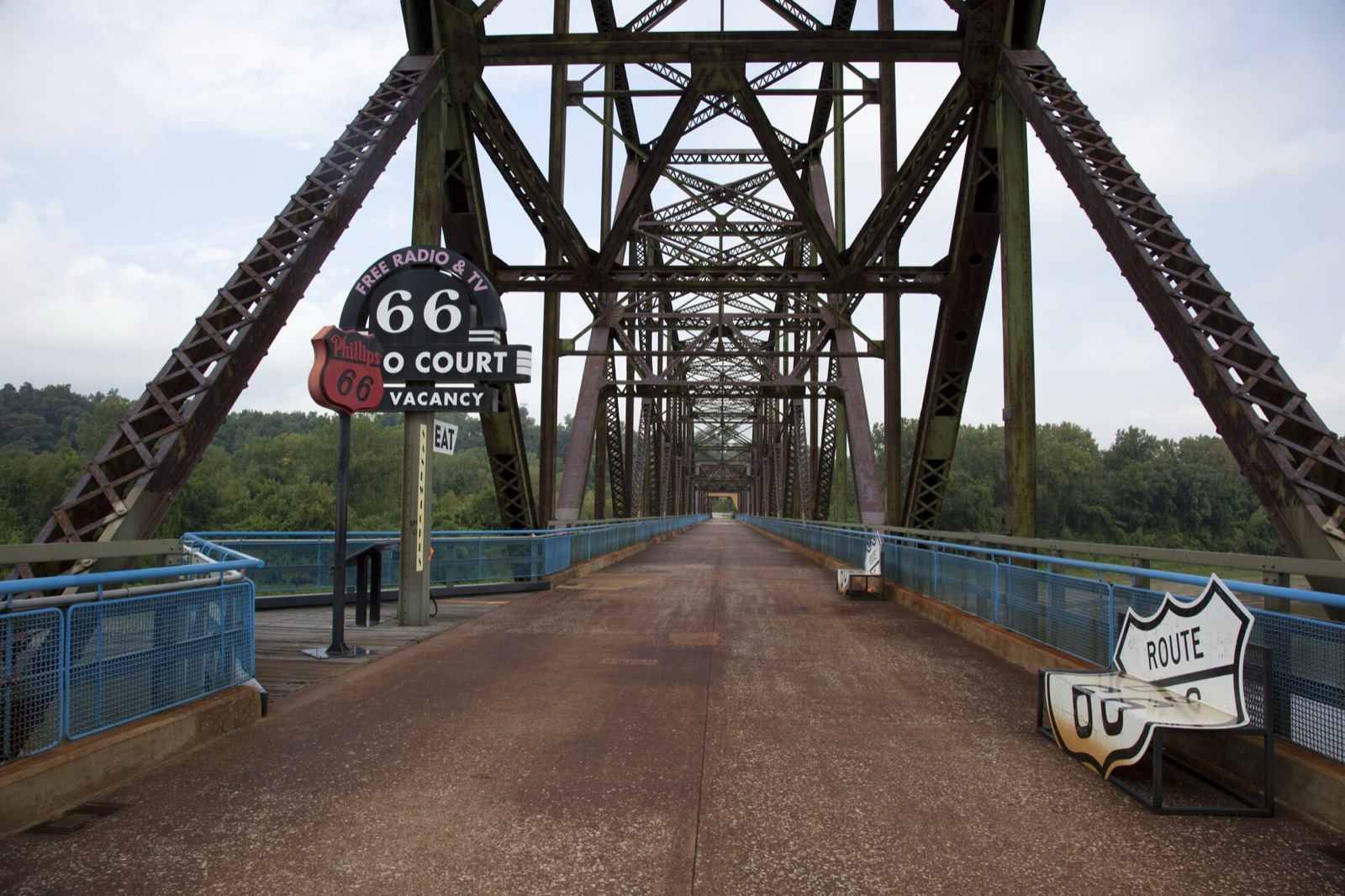
Your last Illinois stop sits right on the state line: the Old Chain of Rocks Bridge, a 1929 crossing over the Mississippi with a 22-degree bend in the middle. It once carried Route 66 traffic and is now open only to walkers and cyclists.
Missouri (about 317 miles)
In St. Louis, get a concrete at Ted Drewes Frozen Custard on Chippewa Street, a Route 66 address since 1941. The custard is so thick they hand it to you upside down.
Cuba calls itself the Route 66 Mural City, and it's a lovely place to walk for an hour. The Wagon Wheel Motel there is often described as the oldest continuously operating motel on the road; it changed owners in April 2026, so call ahead for current rates.
The Missouri stretch runs close to I-44 for long distances, which makes it easy to slip onto the interstate by accident. This is the first state where a good set of maps really earns its keep.
Kansas (about 13 miles)
Kansas is short, so don't rush it. In Galena, Cars on the Route is a restored Kan-O-Tex station next to "Tow Tater," the 1951 boom truck that inspired a character in Pixar's Cars.
A few miles west of Riverton, the Rainbow Bridge over Brush Creek was built in 1923. It's the last surviving Marsh arch bridge on the entire route, and you can still drive across it. More in my guide to Route 66 in Kansas.
Oklahoma (about 432 miles)
Oklahoma is the second-longest state on the route after New Mexico, so slow down here. South of Miami you'll find what's left of the nine-foot-wide "Ribbon Road," paved in the early 1920s. Ottawa County voted in 2024 to grind up part of it, and a compromise kept one mile untouched.
The Blue Whale of Catoosa reopened after a renovation, with a new visitor center that opened on May 30, 2026. Swimming in the pond is no longer allowed, but the visit is free.
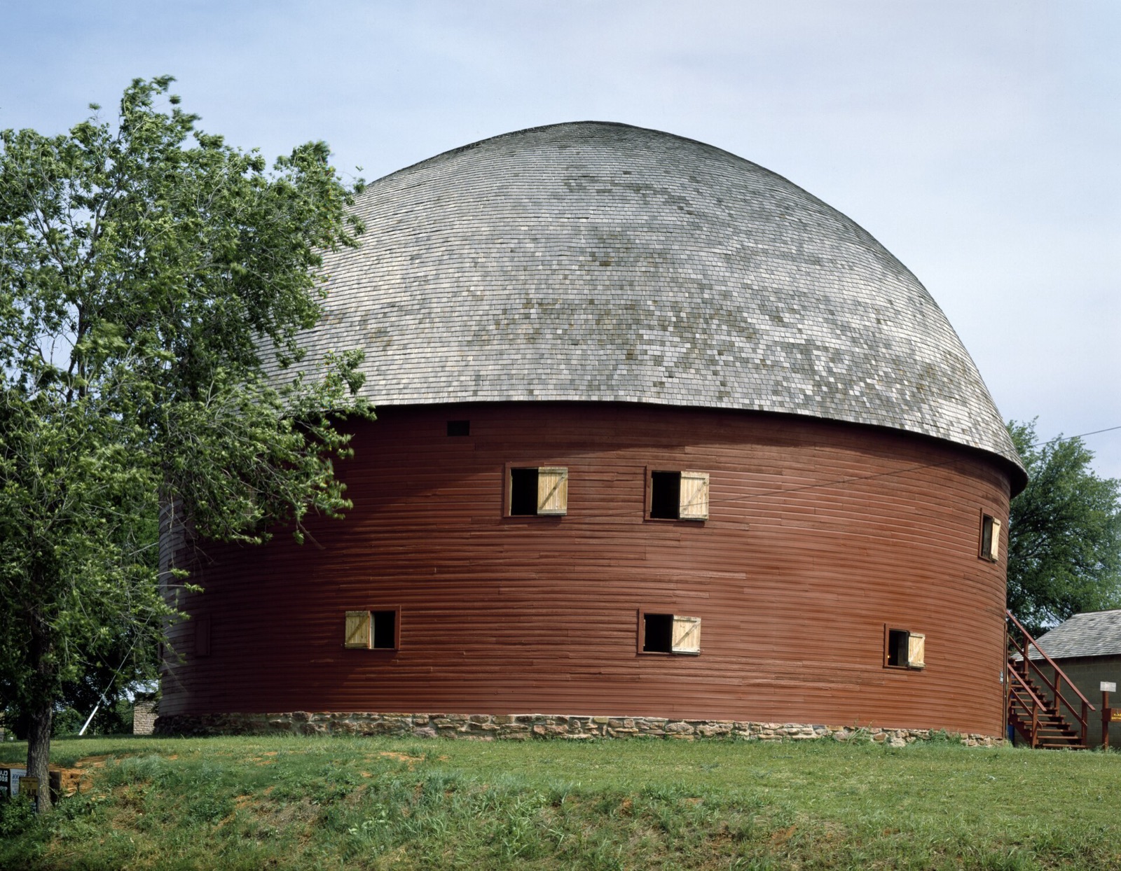
East of Oklahoma City, the Round Barn in Arcadia dates to 1898. Farther west, the Oklahoma Route 66 Museum in Clinton, run by the Oklahoma Historical Society, is the best single museum stop between St. Louis and Albuquerque in my opinion. The full state is in my guide to Route 66 stops in Oklahoma.
Texas (about 186 miles)
The Panhandle goes by fast. In Shamrock, the U-Drop Inn and Tower Conoco Station, built in 1936, now houses a visitor center, and its Art Deco towers are worth the stop alone.
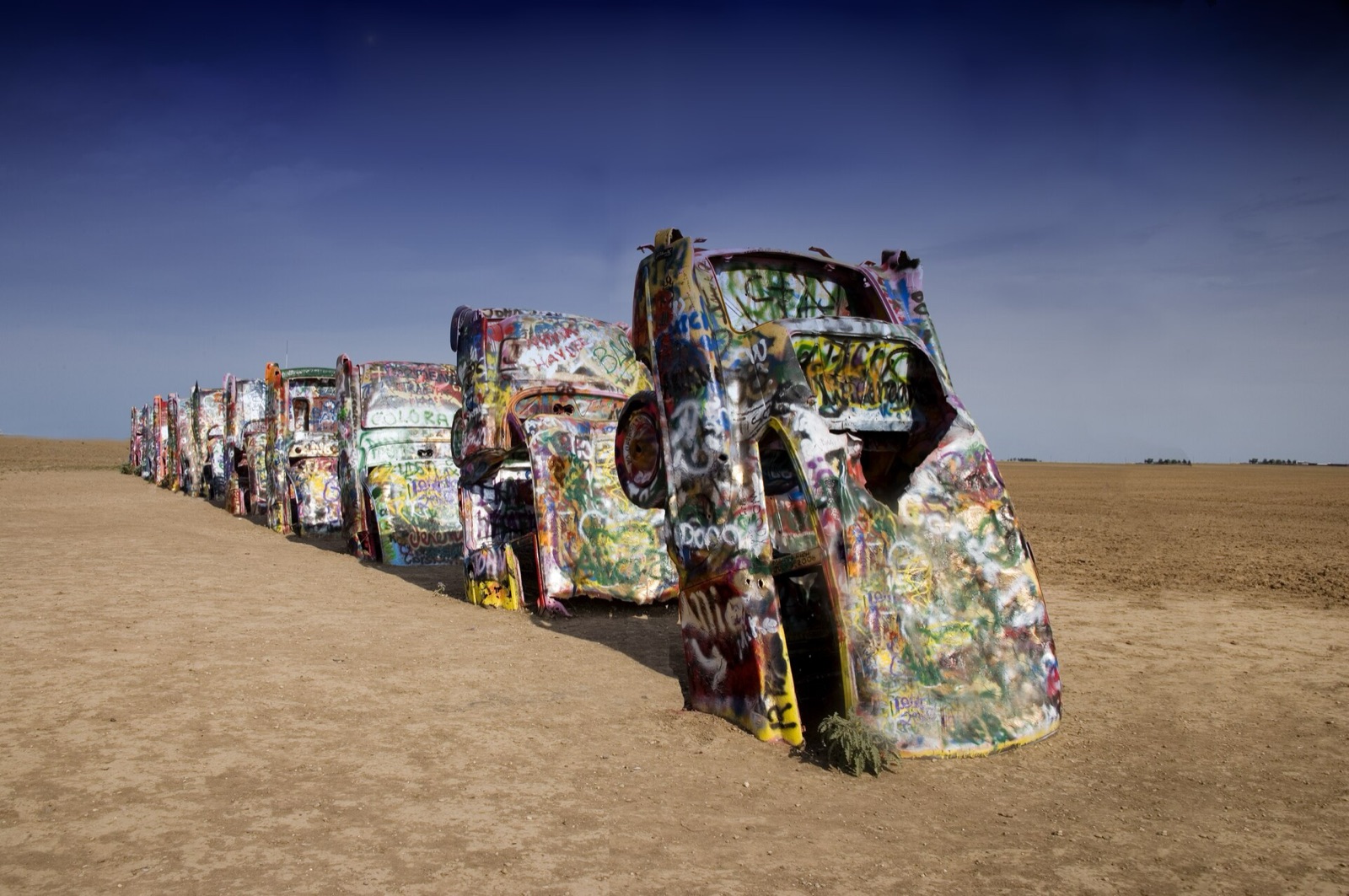
West of Amarillo, Cadillac Ranch is ten Cadillacs buried nose-down in a field since 1974. Bring a can of spray paint; adding a layer is part of the tradition.
Then stop at the Midpoint Cafe in Adrian, which sits at the halfway point, mile 1,139. Order pie, take the photo by the sign, and enjoy the feeling that the second half is all downhill to the ocean.
New Mexico (about 487 miles)
Tucumcari is where the neon starts to matter. The Blue Swallow Motel is the one to book: every room has its own garage next door, and the motel's booking page lists 2026 rates from $119.95 a night for a queen room to $159.95 for the Family Suite.
In Santa Rosa, the Blue Hole is a natural spring-fed pool that stays around 62°F all year. On the same stretch, note that the Cuervo Cafe in Santa Rosa is closed, despite still appearing on plenty of free blogs.
From Santa Rosa you have a choice. The original 1926 to 1937 route swung north through Santa Fe and back down to Albuquerque; the 1937 realignment cut straight west through Moriarty and saved about 107 miles. If you have the time, the Santa Fe loop is a beautiful day. I explain both alignments in Route 66 stops in New Mexico.
Out west in Gallup, the El Rancho Hotel, where Hollywood stars stayed while filming nearby, still names its rooms after them. Six motels in Gallup are red-tagged, so book only a place you've confirmed by phone.
Arizona (about 401 miles)
Petrified Forest National Park is the only national park that contains a segment of Route 66, and there's a pullout with a 1932 Studebaker marking the old alignment. In Holbrook, the Wigwam Motel has rented its 15 concrete teepees to travelers since 1950.
Seligman is where the modern Route 66 revival began. In 1987 local businessman Angel Delgadillo and a small group of residents formed the association that got "Historic Route 66" signs put back up, and the stretch west of town is the longest continuous piece of the old road still in use.
The last big drive in Arizona is the climb over Sitgreaves Pass to Oatman: paved but narrow, with hairpin curves, steep grades and very few guardrails. In Oatman, the wild burros wander the main street; feed them only the hay cubes sold in town, and never in the roadway. More in Route 66 stops in Arizona.
California (about 316 miles)
You enter at Needles, and from there the old road, signed as National Trails Highway, crosses the Mojave. In Amboy, Roy's Motel and Cafe still sells fuel and cold drinks, and it's the only working business in town.
West of Barstow the desert gives way to the Inland Empire and then Los Angeles traffic. Finish at the "End of the Trail" sign on Santa Monica Pier, placed there in 2009; the historic terminus is about a mile away, at Olympic and Lincoln boulevards.
Where to stay on Route 66
Stay in the old motels whenever you can. They're the reason the road still exists, they're usually cheaper than the chain hotels by the interstate, and the owners are the best source of local news you'll find.
Book by phone, not just through an app. A two-minute call tells you right away whether the place is open, whether the room you want is free, and whether the owner is still there. I put together a list of the best Route 66 motels, state by state, for exactly this, and another of the best Route 66 diners still open.
In the bigger stops (St. Louis, Tulsa, Oklahoma City, Amarillo, Albuquerque, Flagstaff) you'll have every kind of hotel. In the small towns between them, there may be one or two choices, so lock those nights in first and plan around them. Traveling in a motorhome? Here are the Route 66 RV parks and campgrounds I'd use.
What a Route 66 road trip costs
Budget depends far more on where you sleep and eat than on the miles. In the Field Manual I built the 14-day plan around three daily budgets, with fuel included in each:
- $80 a day: simple motels, diners and picnic lunches.
- $200 a day: the classic neon motels, a sit-down dinner, a few museum tickets.
- $400 a day: the best rooms on the route, historic hotels, and no counting.
On top of that, plan for your rental and any one-way drop fee, which can be a big line item on a Chicago to Los Angeles trip. Fuel in the desert also costs more than in the cities, sometimes much more, which is one more reason to fill up in town.
Sections you can't drive (or shouldn't, in a rental)
Not every mile of the old road is open, and some of it was never meant for a modern sedan. These are the stretches that cause the most trouble right now:
- Kelbaker Road to Essex, California. Flash floods in 2014 washed out dozens of the old timber bridges on National Trails Highway. Barstow to Amboy has reopened, but as of the latest county updates I could find, the stretch from Kelbaker Road east to Essex was still closed for bridge replacement, with I-40 as the detour. A separate contract to replace ten 1930s timber bridges near Amboy runs until April 2027, so expect work zones there too. Check San Bernardino County Public Works before you go.
- Glenrio to San Jon, New Mexico. About 17 to 20 miles of dirt and gravel through the ghost towns of Endee and Bard. A new bridge washed out in 2023, and the county has said its replacement won't be ready in time for 2026; there's a rough bypass through the wash that's passable only in good weather. I'd skip it in a low car or a rental.
- The Ribbon Road, Oklahoma. Only part of the nine-foot pavement survives. Drive it slowly, pull fully onto the shoulder for oncoming traffic, and don't expect the full original length.
- Sitgreaves Pass, Arizona. Fully paved and fine for most cars, but avoid it with a large RV or a trailer, and never in the dark if you haven't driven it before. Riding it on two wheels? Read my Route 66 motorcycle trip planner first.
Whatever you're driving, read your rental agreement before you take any unpaved road. And remember that conditions on these segments change after every big storm.
Desert driving: fuel, signal and water
From Albuquerque west, the gaps between services get long, and the Mojave is the longest of all. The Bureau of Land Management, which manages the Mojave Trails National Monument around Route 66, puts it plainly: start with a full tank and plan your return before the gauge drops below half.
My rules for the desert are simple:
- Fill up in every real town, even with half a tank. In California that means Needles or Barstow; Roy's in Amboy is a backup, not a plan.
- Carry at least one gallon of water per person per day, which is the BLM's own minimum.
- Download your maps offline. The BLM warns that cell phones don't get a signal everywhere in the monument.
- Tell someone your route and your expected arrival time each morning.
- In summer, drive the Mojave early and be off the road by early afternoon.
Each state chapter of the Field Manual ends with a desert protocol for exactly this: where the last fuel is, where signal drops, and what to do if the car quits.
The most common Route 66 planning mistakes
Letting the navigation app choose the road
Your phone wants to get you there fast, and the fastest road is almost always the interstate. Long pieces of Route 66 run right beside I-55, I-44 and I-40 as frontage roads, and one wrong turn can put you on the highway for an hour before you notice.
Use the app for traffic and for finding your motel at night, but plan each day from a map that shows the old alignments. I explain where the interstate is the smarter choice, and where it robs you of the best parts, in Route 66 vs I-40.
Trusting a guide that hasn't been updated
This road changes every season. Businesses close or change hands, and free blogs keep recommending places that shut years ago.
When I drove the route in April 2026, I found the Cuervo Cafe in Santa Rosa closed, the River Valley Inn in Needles closed, and six motels in Gallup red-tagged. A general guidebook printed a few years back, or an AI-written ebook stitched together from old web pages, will happily send you to all of them.
Driving too many miles a day
Three hundred miles on the interstate is an easy day. Three hundred miles on Route 66, with stops, is exhausting, and you'll arrive after dark at motels where the office has already closed.
Assuming everything is open
Many small museums and cafes keep short or seasonal hours. Call ahead for anything you'd be heartbroken to miss, especially early in spring and late in fall.
Plan it once, then enjoy the road
Route 66 rewards the people who plan the boring parts so they can be spontaneous about the good ones. Settle the number of days and the season first, then book the motels that matter and learn where the desert gaps are.
That's exactly why I made the Route 66 Field Manual: one chapter per state, every waypoint checked on the ground in 2026, and the closures marked as closed. If you're shopping for someone else who's planning this trip, I also put together some Route 66 gift ideas that travelers actually use.
See you on the road.