A Route 66 motorcycle trip covers 2,448 miles from Chicago to Santa Monica, and on a bike I would plan 14 to 16 days at 150 to 200 miles a day. Ride it from May to early June or from mid-September through October, to stay clear of Mojave heat and mountain cold. Most riders rent one-way from Chicago to Los Angeles. Helmets are required for every rider only in California; the other states set an age limit, and Illinois has no helmet law at all. West of Albuquerque, fill up in every real town, because the desert gaps between fuel stops run to 90 miles.
I'm Helena. In April 2026 I drove the whole road, Chicago to Santa Monica, for the Centennial Edition of the Route 66 Field Manual. I did it on four wheels, but I paid close attention to what matters on two: where the fuel is, where the pavement turns to gravel, and which stretches are worth riding twice. This is the motorcycle trip planner I would hand a friend.
How many days for a Route 66 motorcycle trip?
Fourteen days is the honest minimum for the whole road in a car, about 175 miles a day. On a motorcycle I would add one or two days to that. Wind, heat and the constant small-town stops wear you down faster on a bike, and you want to reach the motel with enough energy left to enjoy the evening.
- 10 days or fewer: you will be on I-55, I-44 and I-40 for long stretches, which is the least fun way to ride this road. Better to pick half the route and ride it properly.
- 14 to 16 days: the full road at 150 to 200 miles a day, with time for the good riding sections and a lighter day in the middle.
- 18 to 21 days: rest days in Albuquerque or Flagstaff, the Santa Fe loop, and the freedom to wait out a thunderstorm instead of riding into it.
If you want the full math on days and hours, I break it down in how long it takes to drive Route 66. For the trip as a whole, season, budget and closures included, start with the Route 66 road trip planner.
Best time to ride Route 66
The riding windows are the same as for drivers, only narrower: May to early June, and mid-September through October. On a bike you feel the two hazards of this road directly, desert heat in the west and cold at altitude in Arizona.
The Mojave heats up earlier than people think. In Needles, California, the average high is about 88°F in April, 97°F in May, 106°F in June and 110°F in July, and it is still around 102°F in September before dropping to about 89°F in October. That is why I would rather cross California in October or early May than in June.
Flagstaff sits at about 7,000 feet and averages more than 100 inches of snow a year. In spring and late fall, mornings up there can be cold even when the desert below is warm, so pack layers you can add and remove at fuel stops.
Summer brings one more thing riders need to know about. The National Weather Service counts the Arizona monsoon season from June 15 to September 30, with sudden afternoon thunderstorms, gusty winds and dust. If you ride in late summer, plan to be off the road by mid-afternoon.
Route 66 ride map: the road state by state
Here is the whole route on one table, with the miles, the helmet rule and what to look forward to or watch for in each state. The mileages follow the historic route, including the original Santa Fe loop in New Mexico, so your odometer will differ depending on the alignment you take.
| State | Miles | Helmet law | Best riding | Watch for |
|---|---|---|---|---|
| Illinois | 301 | No law | Small towns south of Joliet, Pontiac | Chicago traffic; Chain of Rocks Bridge is walkers and cyclists only |
| Missouri | 317 | Under 26 | Devil's Elbow and the Ozark hills | Easy to slip onto I-44 by mistake |
| Kansas | 13 | 17 and younger | Rainbow Bridge near Riverton | It is over in half an hour, so slow down |
| Oklahoma | 432 | 17 and younger | Long, quiet two-lane stretches | The nine-foot Ribbon Road near Miami |
| Texas | 186 | 20 and younger (exceptions at 21+) | Shamrock to Adrian | Crosswinds on the open Panhandle |
| New Mexico | 487 | 17 and younger | Santa Fe loop, Tucumcari to Santa Rosa | Glenrio to San Jon gravel; long fuel gaps |
| Arizona | 401 | 17 and younger | Seligman to Kingman, Sitgreaves Pass to Oatman | Hairpins, few guardrails, burros in Oatman |
| California | 316 | All riders | National Trails Highway through Amboy | Heat, the Kelbaker Road to Essex closure, fuel |
The best stretches of Route 66 on a motorcycle
Much of Route 66 is straight and flat, which is relaxing but not the reason most riders come. These are the sections I would build a motorcycle trip around.
Sitgreaves Pass and the Oatman Road, Arizona
This is the one. West of Kingman, the old road climbs through the Black Mountains to Sitgreaves Pass at 3,586 feet, then drops down to Oatman with hairpin curves and steep grades. It is part of a 42-mile Route 66 back country byway managed by the Bureau of Land Management.
It is fully paved, but narrow, with very few guardrails and long drops on the outside of some turns. Ride it in daylight, ride it slowly the first time, and watch for cars stopped in odd places for photos. In Oatman, wild burros wander the main street, so expect them on the road and give them room.
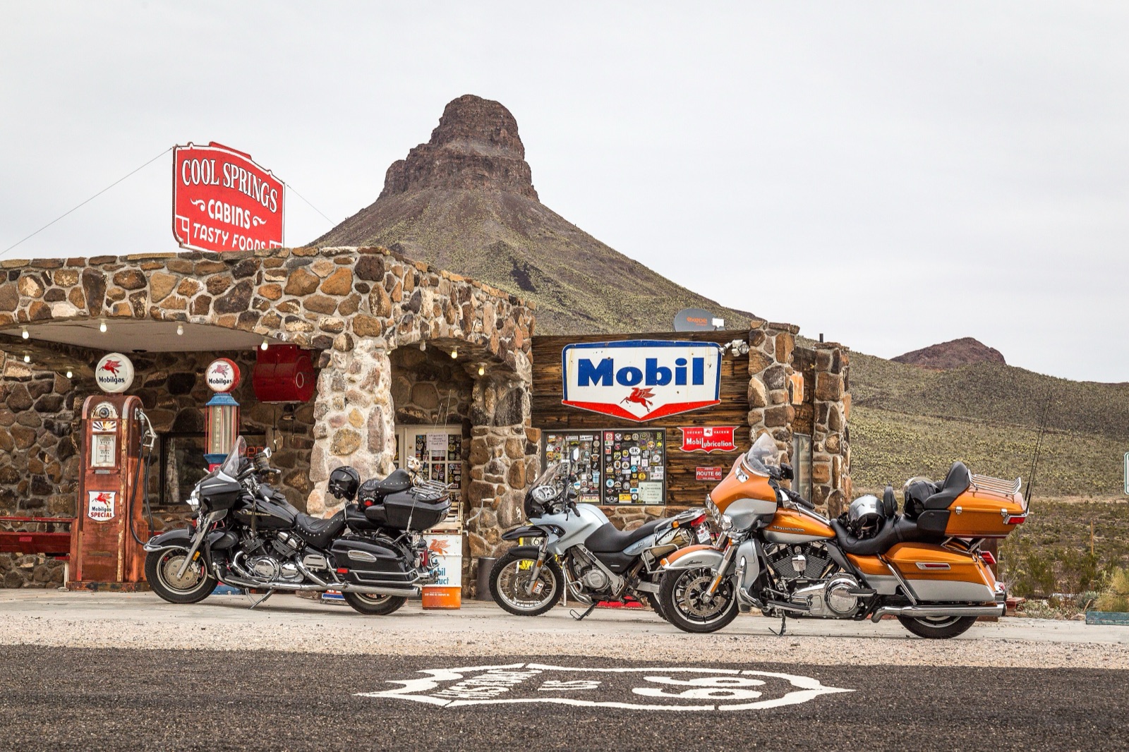
On the way up you pass Cool Springs, a restored stone station from the 1920s that today works as a landmark and gift shop. Treat it as a photo stop, not a fuel stop.
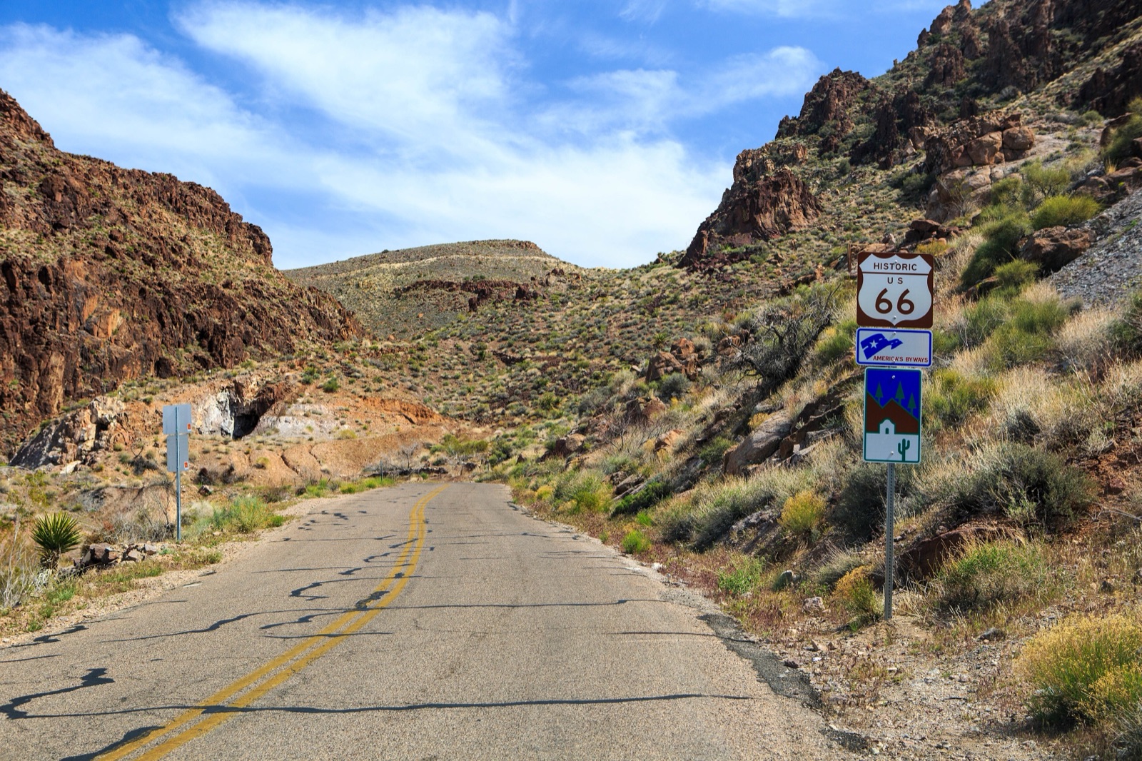
Seligman to Kingman, Arizona
The stretch from Seligman through Peach Springs, Truxton and Hackberry to Kingman is about 89 miles of the old road, and it is the only part of former US 66 in Arizona that still carries state route markers, as State Route 66. It sweeps through open ranch country with long views and very little traffic.
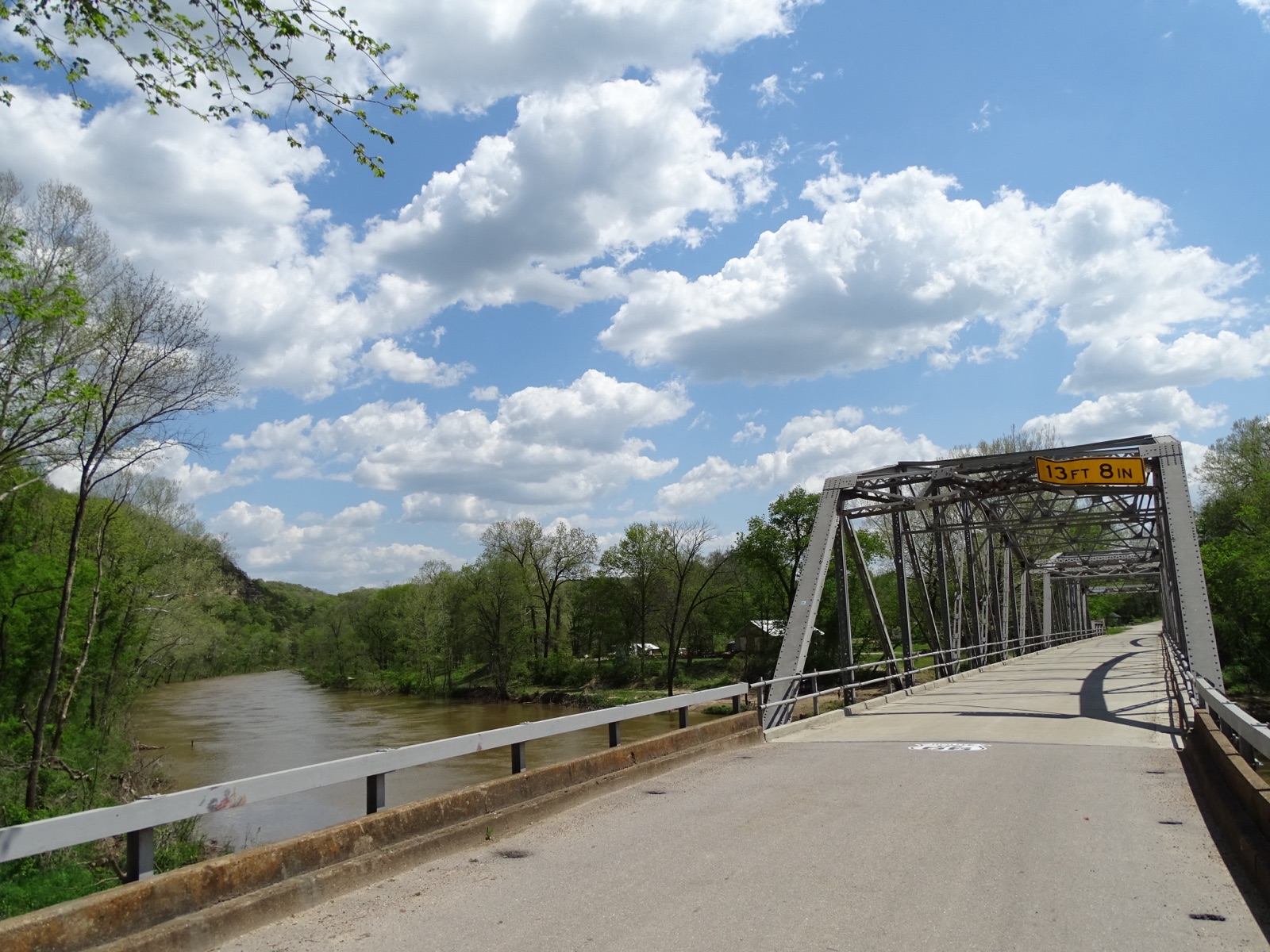
Devil's Elbow, Missouri
In the Ozarks, the original 1926 alignment, now called Teardrop Road, drops down to the Big Piney River at Devil's Elbow. The steel truss bridge there dates to 1923 and was rehabilitated in 2014. It is a short detour off I-44, and one of the few places in the first half of the trip where the road actually curves and climbs.
Oklahoma's long two-lane
Oklahoma has more drivable miles of Route 66 than any other state, roughly 400 of them. That means long, easy days on quiet two-lane road between Tulsa and Oklahoma City and beyond, which is exactly what a touring bike is built for. Near Miami, the nine-foot-wide Ribbon Road from the early 1920s survives in part; ride it slowly and pull fully onto the shoulder for oncoming traffic.
Where not to take a touring bike
- Glenrio to San Jon, New Mexico. About 17 to 20 miles of dirt and gravel, with a rough bypass around a bridge washed out in 2023. On a loaded touring bike, take I-40 instead.
- Kelbaker Road to Essex, California. National Trails Highway is closed here for bridge replacement; the detour is I-40 and Kelbaker Road.
- The Chain of Rocks Bridge, Illinois to Missouri. It is open only to walkers and cyclists. Park and walk out to the bend.
Motorcycle rental and tours for Route 66
Unless you live near Chicago, renting is usually simpler than riding your own bike to the start. Here is how the options compare.
Renting one-way
EagleRider, a national motorcycle rental chain that also runs its own Route 66 tours, has locations at both ends of the route, in the Chicago area and the Los Angeles area, and allows drop-offs at a different location for a one-way fee. Ask for that fee in writing when you book, because it can be a large share of the total. Some motorcycle dealers along the way also rent bikes, but usually for round trips, so call them directly.
Whoever you rent from, you will need a valid motorcycle license or endorsement. If you are visiting from abroad, check with the rental company before you book whether your home license is enough or whether they want an International Driving Permit too. Read the insurance terms closely, and check whether the bike is allowed on unpaved roads, because most rental agreements say no.
Guided and self-guided tours
Several companies run Route 66 motorcycle tours. Guided tours come with a support van, set hotels and riding partners, and usually cost several thousand dollars per rider. Self-guided tours give you the bike, the hotel bookings and a route, and you ride on your own schedule.
A tour suits you if you want everything booked. The tradeoff is a fixed schedule. Plan it yourself and you choose the motels, the pace and the detours, and a good set of maps does the job of the guide.
Heat in the Mojave on a motorcycle
On a bike, desert heat is a safety issue, not a comfort issue, and a breakdown in the Mojave in summer is serious.
The Bureau of Land Management, which manages the Mojave Trails National Monument along Route 66, recommends at least one gallon of water per person per day, and warns that cell phones do not get a signal everywhere in the monument. On a motorcycle that gallon has to fit somewhere, so plan for it before you leave Needles or Barstow.
My rules for riding the desert:
- Ride the Mojave in the early morning and be off the road by early afternoon from May through September.
- Drink at every fuel stop, whether you feel thirsty or not.
- Download your maps offline before you leave town, and tell someone your route for the day.
- Westbound, the afternoon sun is in your eyes from Oklahoma on. Keep a tinted visor or good sunglasses within reach.
Fuel: distances between gas stations in the desert
East of Albuquerque you rarely ride far without a town. West of it, the gaps get long, and they matter much more on a motorcycle with a small tank. These are approximate distances along the route between reliable fuel towns, measured on a map; your exact numbers will depend on alignment and detours.
| Stretch | Approx. miles | Fill up in | Notes |
|---|---|---|---|
| Tucumcari to Santa Rosa, NM | 60 | Tucumcari | Easy, but it is all open plains |
| Santa Rosa to Moriarty, NM (1937 route) | 115 | Santa Rosa | Clines Corners, a travel stop at I-40 and US 285 since 1934, sits in between |
| Grants to Gallup, NM | 62 | Grants | High desert, often windy |
| Gallup, NM to Holbrook, AZ | 96 | Gallup | Sparse services; fill up before the Petrified Forest |
| Seligman to Kingman, AZ | 89 | Seligman | Small towns only in between |
| Kingman to Topock, AZ, via Oatman | 54 | Kingman | Do not count on fuel at Cool Springs or Oatman |
| Needles to Amboy, CA, via I-40 and Kelbaker Road | about 90 | Needles | The longest gap on the route |
| Amboy to Ludlow, CA | 28 | Amboy, if you need it | Small and remote; a backup, not a plan |
| Ludlow to Barstow, CA | 52 | Ludlow | Stations by the I-40 exit at Ludlow |
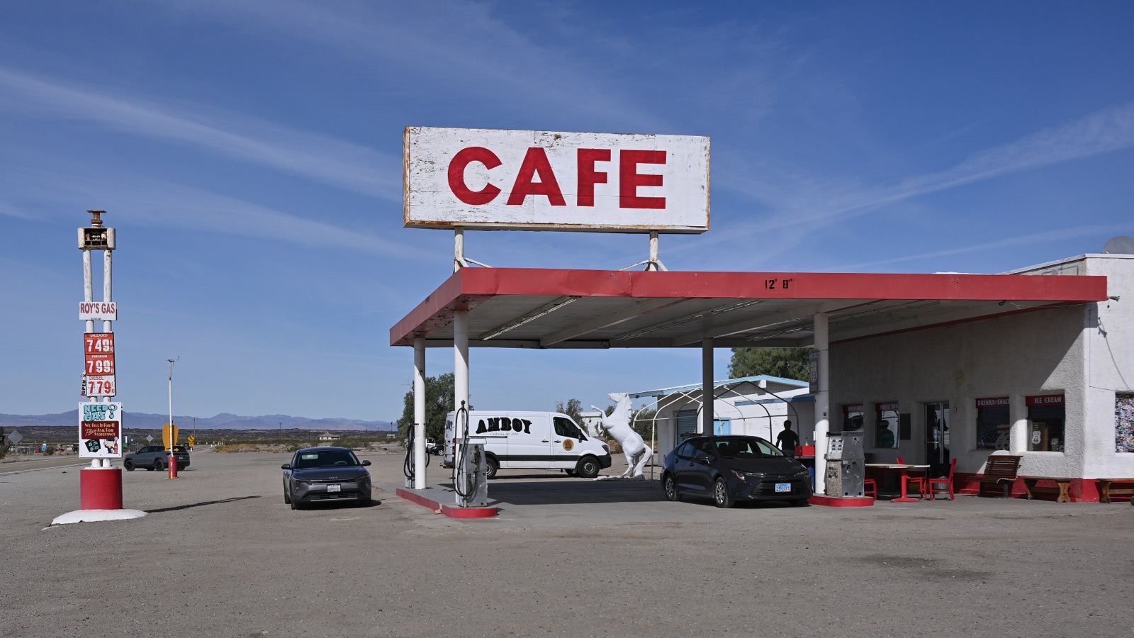
In Amboy, Roy's Motel and Cafe still sells fuel and cold drinks and is the only working business in town. I treat it as a backup, not a plan. If your bike's real-world range is under 150 miles, fill up in every town west of Albuquerque, even with half a tank, and carry a small amount of extra fuel in an approved container for the California desert.
Motorcycle helmet laws on Route 66, state by state
Each state sets its own helmet law, and the rule follows the road, not your license plate. These are the current requirements as listed by the Insurance Institute for Highway Safety, with the details checked against state law where it matters.
| State | Who must wear a helmet |
|---|---|
| Illinois | No helmet law |
| Missouri | Everyone under 26. Riders 26 and older may ride without one, unless they are riding on an instruction permit. |
| Kansas | 17 and younger |
| Oklahoma | 17 and younger |
| Texas | 20 and younger. Riders 21 and older may go without if they have completed an approved motorcycle safety course or carry health insurance that covers injuries from a motorcycle crash. |
| New Mexico | 17 and younger |
| Arizona | 17 and younger |
| California | All riders and passengers |
Practically, if you rent a bike in Chicago and ride to Los Angeles, you will finish in a state where the helmet is mandatory for everyone, so bring one that fits. My advice is simpler than the law: wear it the whole way. The sun, the wind and the bugs on the Texas Panhandle are reason enough.
Two more rules differ along the route. California is the one state on Route 66 where lane splitting is legal, defined in the Vehicle Code since 2017. Arizona allows lane filtering, but only between fully stopped vehicles, on roads with a speed limit of 45 mph or less, at no more than 15 mph. Everywhere else, stay in your lane.
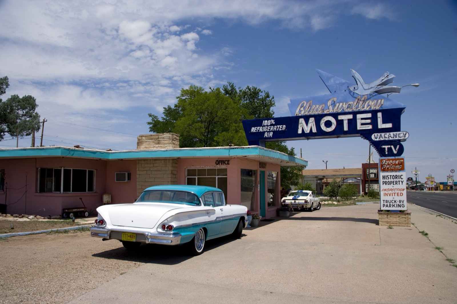
Pack rain gear and warm layers even in May, plus earplugs and a way to carry water on the bike. Keep the rest light. Many of the classic motels have parking right outside the door, which is one of the nicest things about this road on a bike. I listed my favorites, state by state, in the best Route 66 motels.
Plan the ride, then enjoy it
A Route 66 motorcycle trip rewards a little planning. Settle your days and your season first, book the bike one-way, know where the fuel gaps are, and bring a helmet that will satisfy California. Then you can spend your attention on the road itself, which is what you came for.
The Route 66 Field Manual covers all eight states with 169 maps and 105 GPS waypoints you can load into the map app you already use, plus 9 restaurants and 9 hotels per state on three budgets. The printed book and the digital edition come in one order for $47, so you can keep the paper copy in a tank bag and the digital one on your phone. For a day-by-day version of the trip, see my 2-week Route 66 itinerary, and for the stops in the best riding state, my guide to Route 66 stops in Arizona.
See you on the road.