The best Route 66 stops in Arizona, east to west, are Petrified Forest National Park, Holbrook, the famous corner in Winslow, Meteor Crater, Flagstaff, Williams, Seligman, the Hackberry General Store, Kingman and Oatman, on the far side of Sitgreaves Pass. Arizona carried about 385 miles of US 66, and about 250 of them are still drivable, including the longest unbroken piece of the old road left anywhere: almost 158 miles from Crookton Road, just east of Seligman, to Topock on the Colorado River. Give the state three to four days, plus one more if you want the Grand Canyon.
I'm Helena. I drove Arizona from the New Mexico line to the Colorado River in April 2026 for the Centennial Edition of my Route 66 Field Manual, and it's the state I beg people not to rush. Below are the stops in order, the real distances between them, where the old road and I-40 part ways, and the places that have closed or need a phone call first. If you're still at the big-picture stage, start with my Route 66 road trip planner and come back here when you reach the Painted Desert.
Arizona Route 66 at a glance: miles and map
You'll see different mileages for Arizona, and they're all a little bit right. The Historic Route 66 Association of Arizona puts the original highway at 385.2 miles and the drivable part today at about 250. Interstate 40, which replaced it, crosses the state in about 359 miles. In my state-by-state table in the planner I use about 401 miles, because the old road keeps leaving the interstate to loop through towns and over the mountains, and the number depends on which alignments you count.
Here's a trick that makes Arizona easy to plan: the state numbers its I-40 exits by the mile, counting from the California line. Exit 311 is 311 miles from California, exit 233 is 233. Subtract two exit numbers and you have the distance between them. The table below uses exactly that, so these are interstate miles; the old road adds a few here and there.
| Stop | I-40 exit | Miles from previous stop | Why stop |
|---|---|---|---|
| New Mexico state line (Lupton) | 359 | Start | Arizona begins |
| Petrified Forest National Park | 311 | 48 | The only national park with a piece of Route 66 |
| Holbrook | 285 to 289 | About 25 (47 if you drive through the park) | Wigwam Motel, Navajo Boulevard |
| Winslow | 252 to 257 | About 33 | Standin' on the Corner, La Posada |
| Meteor Crater | 233 | About 20, then 6 miles south | A crater about a mile wide |
| Flagstaff | 191 to 204 | About 38 | Mountain town, downtown on Route 66 |
| Williams | 161 to 165 | About 32 | Grand Canyon Railway, last town bypassed |
| Seligman (Crookton Road) | 139 | About 24 | Start of the longest stretch, birthplace of "Historic Route 66" |
| Hackberry | Old road only | On AZ 66 | Hackberry General Store |
| Kingman | 48 to 53 | About 86 from Crookton by I-40, more by the old road | Powerhouse Visitor Center and museum |
| Oatman | Old road only | On the 42-mile Oatman Road | Sitgreaves Pass, wild burros |
| Topock, California line | 1 | End of the Oatman Road | Colorado River |
One more thing to know before you set your watch: Arizona does not observe daylight saving time, so from spring to fall your phone may jump an hour at the state line. If you're timing a park visit or a train, check which clock the place is on.
How many days do you need for Route 66 in Arizona?
Three days is the honest minimum, four is comfortable, and five gives you a full day at the Grand Canyon. The miles aren't huge, but the best of Arizona sits on slow roads: a 28-mile park drive, a mountain pass with hairpin curves, and a long state highway where you'll want to stop at every gas station that still has its pumps.
| Day | Route | Where to sleep |
|---|---|---|
| 1 | New Mexico line, Petrified Forest (28-mile park road), Holbrook | Holbrook or Winslow |
| 2 | Winslow, Meteor Crater, Flagstaff, Williams | Williams |
| 3 (optional) | Grand Canyon South Rim by train or car | Williams |
| 4 | Seligman, Grand Canyon Caverns, Hackberry, Kingman | Kingman |
| 5 | Oatman Road over Sitgreaves Pass, Oatman, Topock, into California | Needles or beyond |
Short on time? Drop the Grand Canyon day and combine days 4 and 5, but leave Kingman early so you cross Sitgreaves Pass in daylight. If you're working out the whole trip, my piece on how long Route 66 takes shows where Arizona fits in a 14-day plan, and the two-week itinerary lays it out day by day.
Petrified Forest National Park
Petrified Forest is the only national park in the country that contains a segment of Route 66, and it's the perfect first stop in Arizona. Westbound, take exit 311, drive the 28-mile park road north to south, and come out on Highway 180, which takes you 19 miles into Holbrook. That's the route the Park Service itself recommends for I-40 travelers, and it costs you less than an hour of extra driving.
The Route 66 pullout is almost 6 miles from the north entrance. A line of old telephone poles and a raised roadbed mark the final alignment of the highway, and a 1932 Studebaker sits beside it, rusting very photogenically. The park keeps daytime hours and the Painted Desert Inn opens later and closes earlier than the visitor centers, so check the times on the park's website the day before.
Holbrook
Holbrook is where you sleep in a teepee. The Wigwam Motel has 15 concrete teepees and vintage cars parked out front, and it's on my list of the best Route 66 motels, with the details on booking. Even if you stay elsewhere, drive Navajo Boulevard and Hopi Drive after dark, when the old signs light up.
Winslow: standin' on the corner
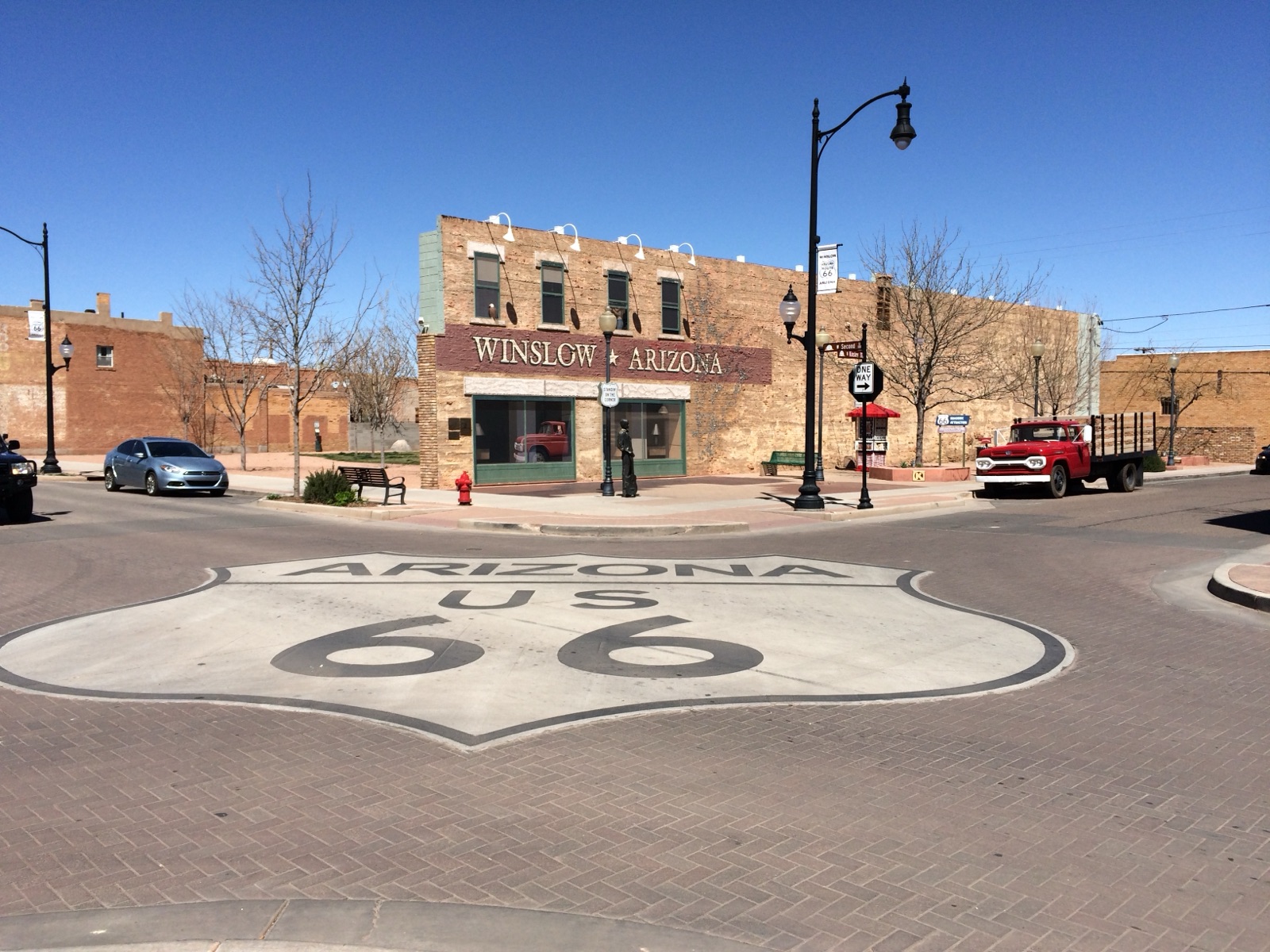
Yes, you'll stand on the corner. Standin' on the Corner Park, built around the line from the Eagles song "Take It Easy," has a bronze of a guitar player and a mural of the girl in the flatbed Ford, with a giant Arizona US 66 shield painted on the street. Everyone does it.
Then walk a few blocks to La Posada, the last of the great hotels built by Fred Harvey and the Santa Fe Railway. Mary Colter designed it, and it opened in 1930. It closed as a hotel in 1957, became railroad offices, was bought in 1997 to save it, and has been restored as a hotel and restaurant. The station next door is still an Amtrak stop. Have lunch there even if you don't spend the night.
Meteor Crater, Two Guns and Twin Arrows
West of Winslow, take exit 233 and drive about 6 miles south to Meteor Crater. The crater is about a mile across and 550 feet deep, made roughly 50,000 years ago, and it is privately run, so it is not covered by a national park pass. It's open daily from 8 a.m. to 5 p.m. In 2026, the walks down to the crater floor were paused for trail restoration, while rim tours and the observation points stayed open. Check before you go if the floor is the reason you're stopping.
Between the crater and Flagstaff, the exits for Two Guns (230) and Twin Arrows (219) lead to the ruins of old Route 66 businesses: an abandoned gas station, garage bays, a trading post and its two big arrows. They are on private land and in poor shape. Look and photograph from the road, and don't climb through anything.
Flagstaff
Flagstaff sits at about 7,000 feet, which is why it's cool in summer and snowy in winter. Route 66 runs right through downtown, next to the railroad tracks, and the historic center is easy to walk. Lowell Observatory, on Mars Hill just west of downtown, is where Clyde Tombaugh discovered Pluto in 1930; it runs public programs and evening telescope viewing.
It makes a good rest day in the middle of a long trip: every kind of hotel and food, which you won't see again until Kingman.
Williams and the Grand Canyon detour
Williams was the very last town on Route 66 to be bypassed by the interstate. I-40 went around it on October 13, 1984, and the whole downtown still feels like the highway never left. It's also the best base for the Grand Canyon.
You have two ways to get there. The Grand Canyon Railway leaves Williams daily at 9:30 a.m. (8:30 a.m. in November and December) and gets you back at 5:45 p.m. (4:45 p.m. in those two months), with a little over three hours at the South Rim. Or drive: the Park Service puts the South Entrance about 60 minutes from Williams and 90 minutes from Flagstaff. Either way, it's a full day, and that's why I build it in as its own day and sleep in Williams twice.
If you've never seen the Grand Canyon, this is the one side trip on the whole route I'd never tell you to skip.
Seligman to Kingman: the longest stretch of Route 66 left
West of Williams, get off I-40 at exit 139, Crookton Road. From here to Topock, the Historic Route 66 Association of Arizona counts 157.87 miles of uninterrupted old road, the longest continuous stretch of Route 66 that survives. The part between Seligman and Kingman is State Route 66, and it swings north of the interstate through Peach Springs, Truxton, Valentine and Hackberry. I-40 cuts straight across; the old road takes the long way, and that's the point.
Seligman
Seligman is where the modern Route 66 revival started. When I-40 bypassed the town in 1978, traffic disappeared almost overnight. In 1987 the local barber, Angel Delgadillo, born in Seligman in 1927, founded the Historic Route 66 Association of Arizona and got "Historic Route 66" signs put back up. His family finished restoring his father's original 1923 barbershop building in April 2026.
The Snow Cap Drive-In, run for decades by Angel's late brother Juan, is the town's famous food stop and known for its joke signs. Hours are seasonal, so call ahead. I wrote more about it in my guide to the best Route 66 diners.
Grand Canyon Caverns, Peach Springs and Truxton
East of Peach Springs, the Grand Canyon Caverns are among the largest dry caverns in the United States. Peach Springs itself is on the Hualapai Reservation. Fill up whenever you see a working pump on this stretch, because the gaps between services are long.
Hackberry General Store
The Hackberry General Store opened in 1932 as the Northside Grocery. In the 1990s the Route 66 artist Bob Waldmire owned it and turned it into the roadside attraction it is today, with old cars, rusty pumps and a yard full of petroliana. Today it's a souvenir shop with cold drinks, about 20 miles before Kingman. Call ahead if you're coming late in the day.
Kingman
Kingman's Powerhouse Visitor Center, at 120 West Andy Devine Avenue, is free and holds the Arizona Route 66 Museum, which charges a small admission, plus an electric vehicle museum and a gift shop. They also hand out free highway maps for the surrounding states, which is handy before the desert. El Trovatore, the pre-war motel with the neon tower, is one of the places I'd sleep here.
Oatman and Sitgreaves Pass
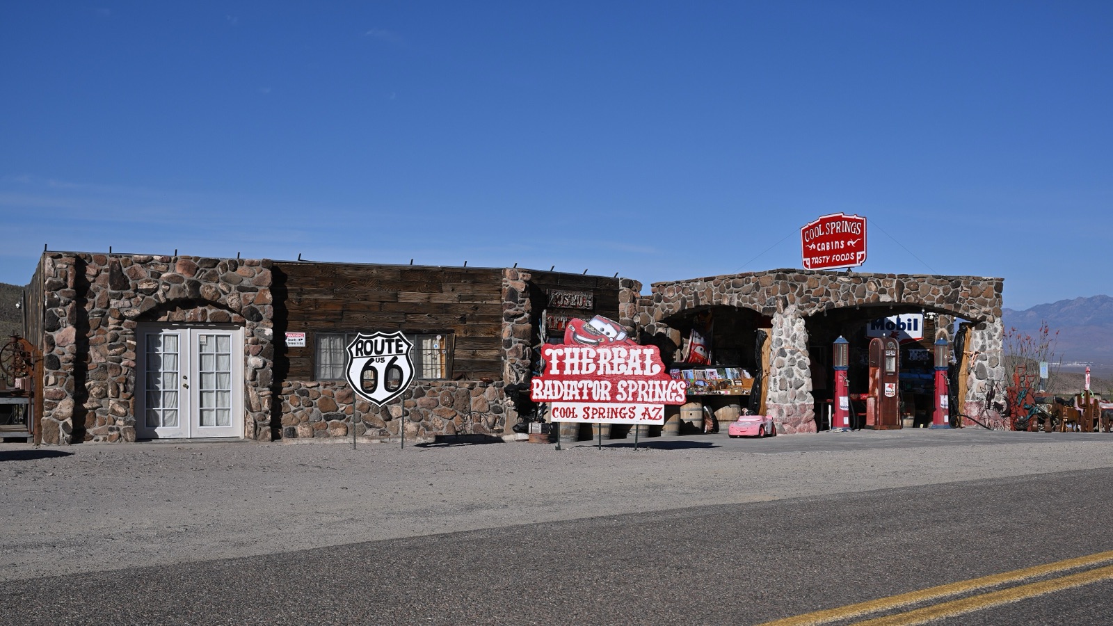
From Kingman, take exit 44, McConnico, and follow the Oatman Road. The Bureau of Land Management calls it the Route 66 Historic Back Country Byway: 42 miles of paved two-lane through the Black Mountains, ending at exit 1 in Topock. On the way up you pass Cool Springs Station, and then the road climbs to Sitgreaves Pass at 3,586 feet, with hairpin curves and steep grades on both sides.
Vehicles longer than 40 feet are not allowed over the pass between Golden Valley and Oatman, so take I-40 if you're in a big RV or towing. The BLM also warns about extreme heat and flash floods. Drive it in daylight, go slowly, and use a low gear on the way down. I compared this road with the interstate in Route 66 vs I-40, and if you're on two wheels, my motorcycle trip planner covers the pass too.
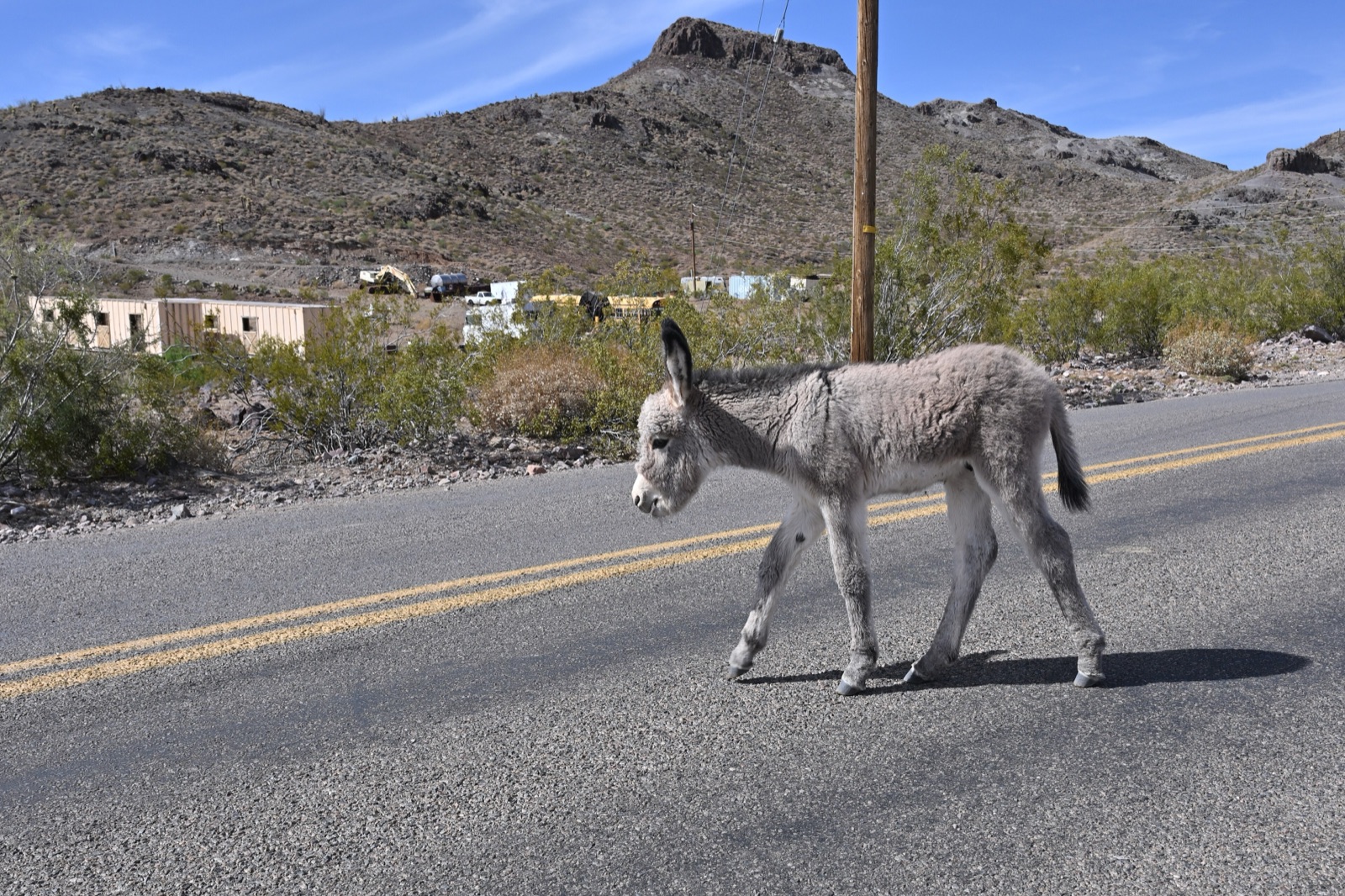
In Oatman, the wild burros walk down the main street and right up to cars. Feed them only the hay cubes sold in town, never in the roadway, and give the babies space.
Where to sleep on Route 66 in Arizona
I won't repeat the motel list here; it's all in the best Route 66 motels, state by state. In short: the Wigwam in Holbrook for the teepees, La Posada in Winslow for the history, Williams for the Grand Canyon nights, and El Trovatore in Kingman for the neon. Book the famous ones first, and call them directly.
Williams fills up fast around train and event weekends, so check the centennial events calendar before you fix your dates.
Closed, paused or worth a phone call
Arizona has fewer closures than the states east of it, but these are the ones that catch people out:
- Meteor Crater floor tours. Paused for trail restoration in 2026; rim tours run.
- Two Guns and Twin Arrows. Ruins on private land, not attractions. Look from the road.
- Snow Cap Drive-In, Seligman. Seasonal hours. Call ahead.
- Hackberry General Store. Open as a souvenir shop, but small places keep short hours. Call ahead late in the day.
- Sitgreaves Pass. Open and paved, but closed to vehicles over 40 feet, and not a road for the dark.
This is exactly how the Field Manual treats the whole route: closed places are marked closed, and anything uncertain is flagged "verify operating status before travel." For Arizona, the chapter lists nine hotels and nine restaurants on three budgets, with GPS waypoints for the turnoffs that are easy to miss, like Crookton Road and the McConnico exit.
The short version
Drive Arizona east to west: the Petrified Forest in the morning, the corner in Winslow by afternoon, a night in Williams, the Grand Canyon if you've never seen it, then the long, lonely stretch from Crookton Road to the Colorado River. When you cross into New Mexico the other way, or want to see what comes before Arizona, read my guide to Route 66 stops in New Mexico.
And if you want every stop, every map and the 105 GPS waypoints for all eight states in one place, the Route 66 Field Manual comes as a printed book and a digital edition in one order. See you on the road.