The essential Route 66 stops in New Mexico, east to west, are Tucumcari and its neon motels, the Blue Hole in Santa Rosa, Albuquerque's 18 miles of Central Avenue, Laguna Pueblo and Acoma's Sky City, Grants, the Continental Divide and Gallup. The big decision is the alignment. From 1926 to 1937, Route 66 looped north from Santa Rosa through Santa Fe and back down to Albuquerque; after 1937 it ran straight west through Moriarty, the line I-40 follows today. The loop adds roughly 100 miles and a day. Plan three days for New Mexico, or four with Santa Fe.
I'm Helena. I drove New Mexico in April 2026 for the Centennial Edition of my Route 66 Field Manual, and of all eight states it's the one where the map matters most, because the road you're driving depends on which decade you choose. Below are the stops in order, the real distances, both alignments explained properly, and the places that have closed. For the whole trip from Chicago to Santa Monica, start with my Route 66 road trip planner.
New Mexico Route 66 at a glance: miles and map
Mileage for New Mexico is all over the place, and now you know why. Visit Albuquerque puts the 1926 road at 507 miles across the state and the 1937 road at 399, and the National Park Service says the realignment cut the trip by about 100 miles. Interstate 40, which replaced the newer line, crosses New Mexico in about 374 miles. In my state-by-state table in the planner I count about 487 miles, because it includes the Santa Fe loop.
New Mexico, like Arizona, numbers its I-40 exits by the mile, but here the count starts at the Arizona line. Glenrio, on the Texas border, is mile 373. Subtract exit numbers and you have the distance. These are interstate miles, and the old road adds a little everywhere.
| Stop | I-40 exit | Miles from previous stop | Why stop |
|---|---|---|---|
| Glenrio (Texas line) | About 373 | Start | Ghost town on the state line |
| San Jon | 356 | 17 | End of the gravel original alignment |
| Tucumcari | 329 to 335 | About 23 | Neon motels, murals |
| Santa Rosa | 273 to 277 | About 58 | Blue Hole, Route 66 Auto Museum |
| US 84 junction (pre-1937 turnoff) | 256 | About 19 | Where the Santa Fe loop heads north |
| Clines Corners | 218 | About 38 | Post-1937 line across the plains |
| Moriarty | 194 to 197 | About 22 | Estancia Valley |
| Albuquerque (I-25) | 159 | About 37 | Central Avenue, where 66 crosses itself |
| Rio Puerco Bridge | 140 | About 19 | 1933 steel truss, walk only |
| Laguna | 114 | About 26 | San José de la Laguna mission, 1699 |
| Grants | 81 to 85 | About 29 | Neon arch, mining museum, side trip to Acoma |
| Continental Divide | 47 | About 34 | Campbell Pass, about 7,270 feet |
| Gallup | 16 to 26 | About 25 | El Rancho, summer dances |
| Arizona line | 0 | About 20 | Next stop, the Petrified Forest |
Pre-1937 vs post-1937: the Santa Fe loop, explained
This is the part most guides get muddled, so here it is plainly. When Route 66 was born in 1926, New Mexico didn't build a new road for it. The highway was laid over older routes, mainly the National Old Trails Road, and those went where the old trails went: north to Santa Fe, then south along the Rio Grande.
The 1926 to 1937 route, through Santa Fe
According to the National Park Service, the first Route 66 ran north from Santa Rosa along the corridor of the Santa Fe Trail to Romeroville, near Las Vegas, then west to Santa Fe. From Santa Fe it turned south along the Camino Real, past Santo Domingo Pueblo, through Albuquerque on Fourth Street, and on down to Los Lunas and Isleta Pueblo before turning west again. On the way it climbed Glorieta Pass and, south of Santa Fe, dropped off La Bajada, a volcanic escarpment, on a series of hairpin switchbacks.
Today you can follow most of that loop on US 84, I-25 and local roads, and in Santa Fe an official Route 66 marker stands at the Old Santa Fe Trail and Water Street, a short walk from the Plaza and La Fonda. The Albuquerque Journal traced the loop in July 2026 and found some sections poorly documented or left to unmaintained county roads, so treat it as a scenic drive, not a purist's checklist.
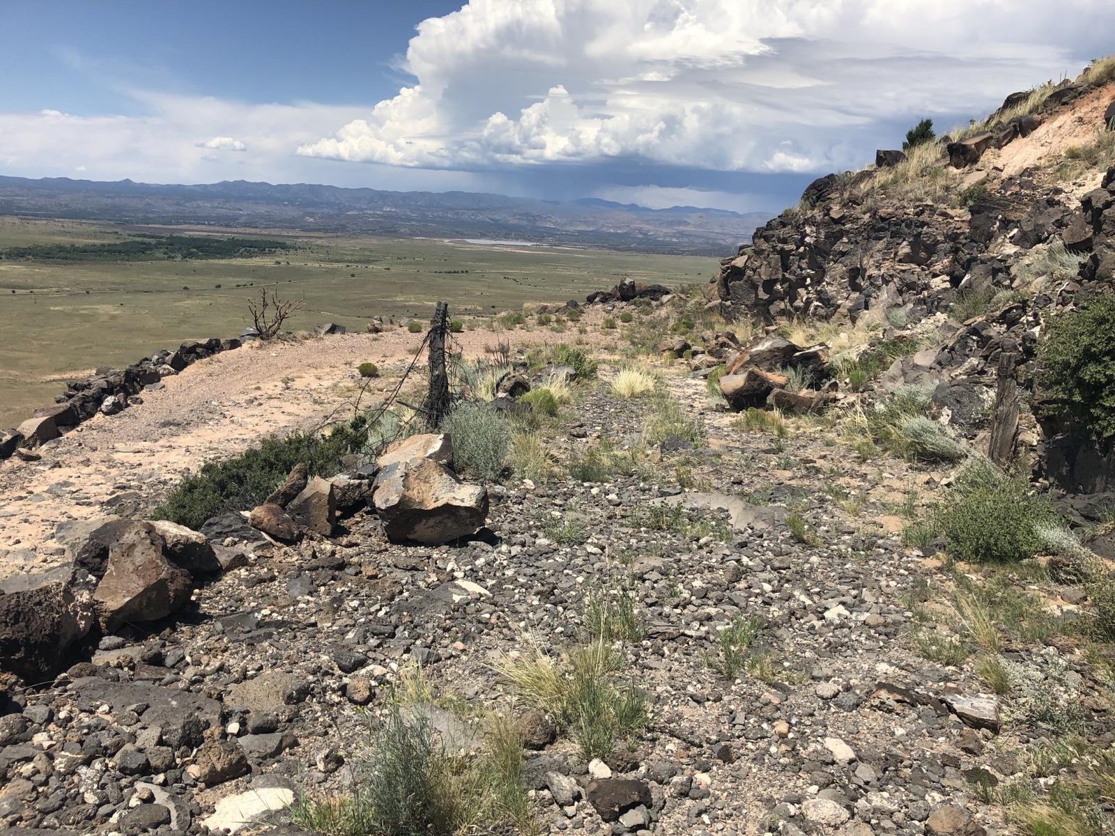
One piece you cannot drive: La Bajada itself. Route 66 used the switchbacks only from 1926 to 1932, when the highway moved a few miles east, close to today's I-25. The old grade is badly eroded, and since 2017 Cochiti Pueblo has closed access to the area to protect it. See it from the highway and leave it alone.
The 1937 realignment, straight through Albuquerque
The straight line has a political story. Governor Arthur Hannett, a Democrat who lost his 1926 reelection, used the end of his term to push through a cutoff from Santa Rosa toward Albuquerque that bypassed Santa Fe. Legend says he drew it with a pen and a ruler; the Albuquerque Journal notes that historians argue about his real motive. Locals called it "Hannett's Joke." Once paving was finished, Route 66 was officially moved to the shorter line in September 1937: across the plains through Clines Corners and Moriarty, through Tijeras Canyon, down Central Avenue in Albuquerque, then west over the Rio Puerco to Laguna.
Which one should you drive?
If you have the time, do the loop. Santa Fe is one of the loveliest towns on the whole route, and you'll drive the Route 66 of the 1920s, not the version everyone else drives. Turn north on US 84 at exit 256, spend the night in Santa Fe, and come down to Albuquerque the next day. You'll meet the newer line again at Fourth and Central. New Mexico is the only state where Route 66 crosses itself, and this is the spot.
If you're tight on days, take the post-1937 line. It's the classic neon-and-motels Route 66, and it's the one I'd choose with a fourteen-day trip and no buffer.
Glenrio, San Jon and Tucumcari
You enter New Mexico at Glenrio, a ghost town that straddles the Texas line. Between Glenrio and San Jon, the original road is 17 miles of gravel through Endee and Bard. A 2023 flood took out the bridge on that stretch, and it's only passable for most cars in dry weather. After rain, or in a low rental, take I-40.
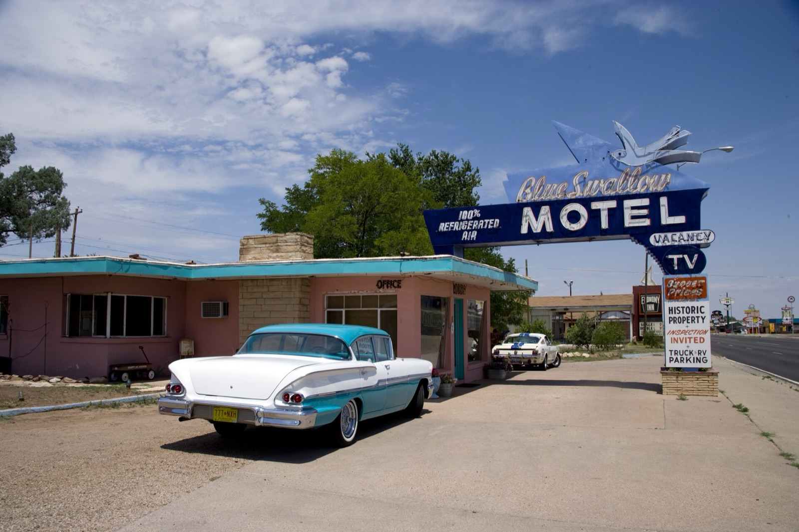
Tucumcari is where New Mexico's neon begins, and it deserves a night. The town has around 100 murals, the Route 66 monument with its chrome tailfin, made by sculptor Tom Coffin in 1997, and Tee Pee Curios, a souvenir shop with one of the best neon signs on the road. For the motels, the Blue Swallow, Motel Safari and the Roadrunner Lodge, see the best Route 66 motels; I won't repeat them here. Drive Route 66 through town after dark at least once.
Santa Rosa and the Blue Hole
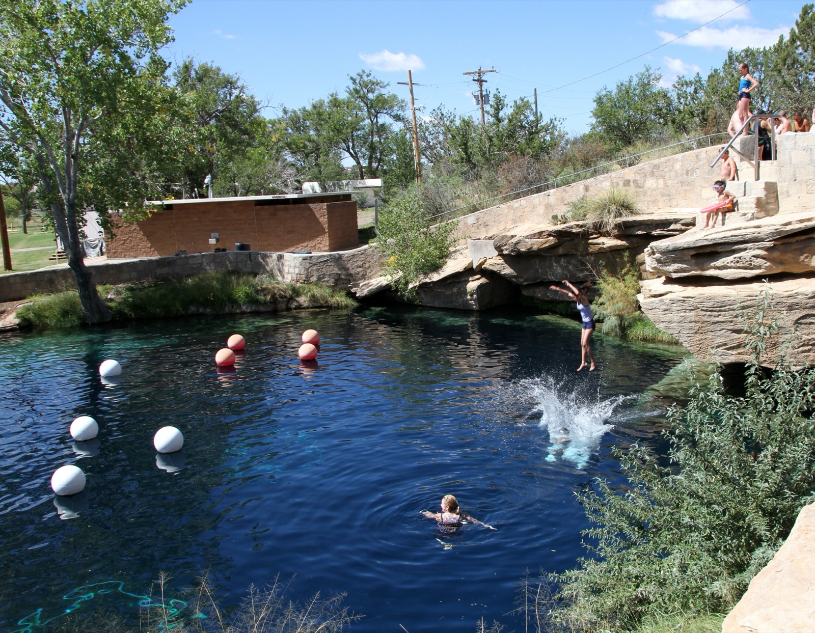
The Blue Hole is a spring-fed pool in the middle of Santa Rosa, more than 80 feet deep and about 62°F all year. Swimmers cool off in it on hot afternoons, and scuba divers come to train. It closed in June 2024 after a rock collapsed underwater and reopened to swimmers that August, so if you're planning to swim or dive, check that it's open before you go.
On the old road through town, look for the yellow 1930 Ford Model A on a pole: it marks the Route 66 Auto Museum, opened more than 20 years ago by Anna and James "Bozo" Cordova, with over 30 cars inside. One closure to note here: the Cuervo Cafe in Santa Rosa is closed, though older blogs still list it.
Albuquerque: 18 miles of Central Avenue
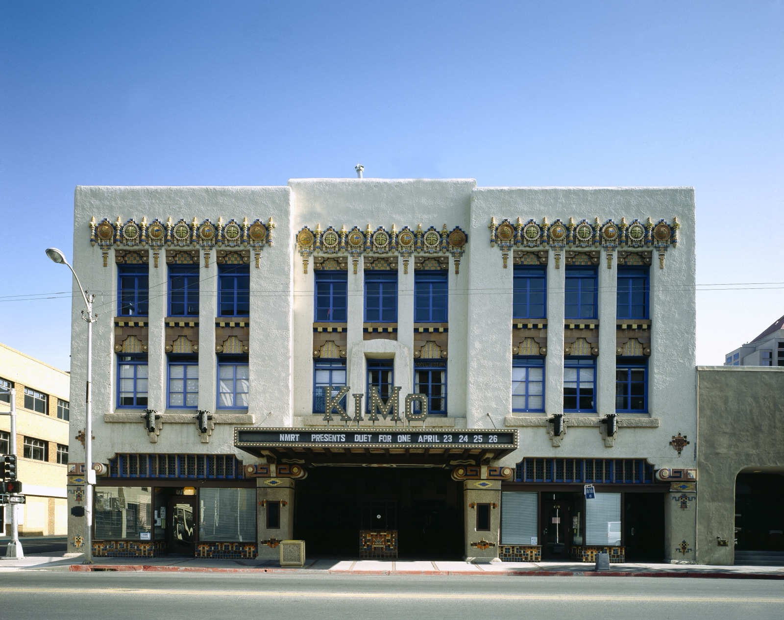
Albuquerque has the longest continuous urban stretch of Route 66 anywhere: Central Avenue, about 18 miles from east to west. For the centennial the city created Route 66 Remixed, a self-guided art tour along its whole length. Start at the KiMo Theatre, 423 Central NW, built in 1927 in the Pueblo Deco style and still a working performance venue. Then walk to Fourth and Central, where the 1926 road and the 1937 road cross.
On the west side of town, the city's Route 66 Visitor Center at 12300 Central SW has exhibits, murals and an amphitheater. It keeps limited days, so check before you drive out. Albuquerque is also a natural rest day: a big city with every kind of hotel and restaurant, halfway across the state.
Leaving town to the west, the Rio Puerco Bridge at exit 140 is a 1933 steel Parker truss that carried cars until 1999. It's open to people on foot now, and worth five minutes.
Laguna Pueblo and Acoma Sky City
At exit 114, Laguna Pueblo is home to San José de la Laguna Mission, built in 1699 and still a working parish church. Remember that the pueblos are living communities: follow posted rules, especially about photography, and don't wander into homes or private areas.
A few miles farther west, a side road runs south to Acoma Pueblo, the Sky City, a village on top of a mesa and one of the oldest continuously inhabited communities in North America. Visits start at the Sky City Cultural Center and Haak'u Museum, where guided tours leave every hour from 9:30 a.m. to 3:30 p.m. The pueblo closes for cultural events, sometimes for several days, and cameras are not allowed on feast days, so check the cultural center's website or call before you make the detour. Give it half a day.
Grants and the Continental Divide
Grants was a uranium boom town in the 1950s and '60s, and the New Mexico Mining Museum tells that story, with a mock-up of an underground mine. On Route 66 through town you can drive under an 18-foot neon arch with flames and a highway shield. New Mexico's tourism office notes that Grants is the only place where the Continental Divide Trail, Route 66 and the New Mexico Backcountry Discovery Route meet.
West of Grants, at exit 47, Route 66 crosses the Continental Divide at Campbell Pass, about 7,270 feet up. Stop for the sign. From here the rivers drain toward the Pacific, and so do you.
Gallup
Gallup is the last big stop before Arizona. Hotel El Rancho, opened in 1937, where Hollywood stars stayed while filming nearby, is the place to sleep or at least to walk through the lobby. In summer, Native American dance groups perform in the evening on Tuesdays, Wednesdays and Thursdays at the downtown Courthouse Square; the 2027 season is listed from June 1 to August 12.
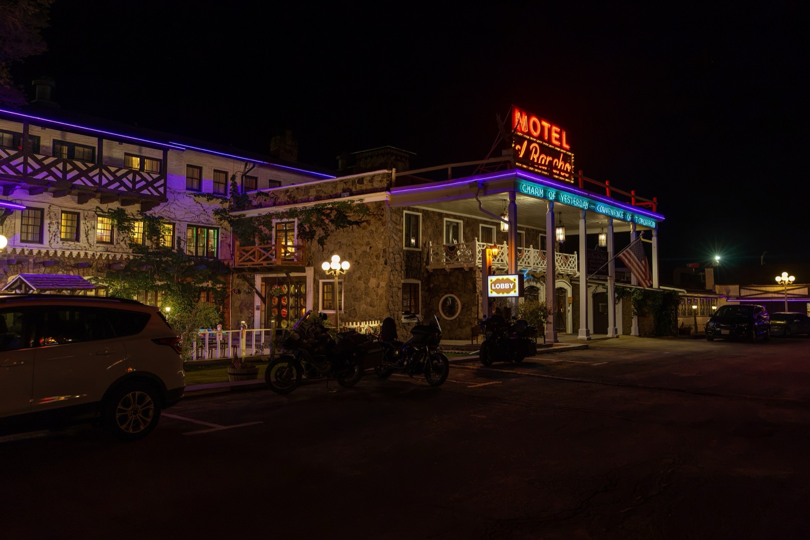
A warning for Gallup: when I checked, six motels in town had been red-tagged by the city. Book only a place you've confirmed by phone.
How many days for Route 66 in New Mexico?
| Plan | Day by day |
|---|---|
| 3 days, post-1937 line | Day 1: Glenrio to Tucumcari. Day 2: Santa Rosa, Clines Corners, Moriarty, Albuquerque. Day 3: Laguna, Acoma, Grants, Gallup. |
| 4 days, with the Santa Fe loop | Day 1: Glenrio to Tucumcari. Day 2: Santa Rosa, north on US 84, Santa Fe. Day 3: Santa Fe to Albuquerque on the old line. Day 4: Laguna, Acoma, Grants, Gallup. |
For how New Mexico fits into the whole drive, see how long Route 66 takes and the two-week itinerary. If you're coming from the east, my Route 66 map with cities shows the order of every town.
Closed or uncertain in New Mexico
- New Mexico Route 66 Museum, Tucumcari. Permanently closed in July 2025.
- Cuervo Cafe, Santa Rosa. Closed.
- Six motels in Gallup. Red-tagged by the city at the time of my drive.
- La Bajada switchbacks. Access closed by Cochiti Pueblo since 2017.
- Glenrio to San Jon. Gravel, with a washed-out bridge. Dry weather only.
- Blue Hole and Acoma. Open, but both have closed at short notice. Check the day before.
That's how I built the whole Field Manual: closed places are marked closed, and anything uncertain is flagged "verify operating status before travel." For New Mexico it lists nine hotels and nine restaurants on three budgets, so you're never guessing where tonight's bed or dinner is.
The short version
Sleep in Tucumcari, swim the Blue Hole if it's open, take the Santa Fe loop if you can spare a day, drive Central Avenue after dark, and stand on the Continental Divide before Gallup. Then keep going west: my guide to Route 66 stops in Arizona picks up at the state line. Wondering how much of the old road is left next to the interstate? I covered that in Route 66 vs I-40.
The Route 66 Field Manual covers all 2,448 miles and eight states, with 169 maps and 105 GPS waypoints, printed and digital in one order. See you on the road.